File:Admiralty Chart No 2480 Block Island to Great Egg Harbour including Long Island Sound, Published 1857 (cropped).jpg

Size of this preview: 630 × 599 pixels. Other resolutions: 252 × 240 pixels | 505 × 480 pixels | 807 × 768 pixels | 1,077 × 1,024 pixels | 1,413 × 1,344 pixels.
Original file (1,413 × 1,344 pixels, file size: 423 KB, MIME type: image/jpeg)
Captions
Captions
Add a one-line explanation of what this file represents
Summary
edit| Description |
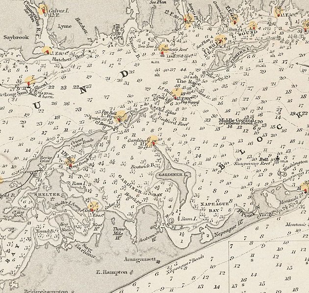
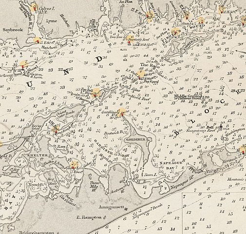
English: Nautical chart of Block Island to Great Egg Harbour including Long Island Sound. Not current - not to be used for navigation! |
| Date | |
| Source | https://archive.org/details/McGillLibrary-rbsc_map_bayfield-131-19309 |
| Author | Capt. Washington, Hydrographer |
| Other versions |


.jpg&action=edit§ion=1)
Licensing
edit.jpg&action=edit§ion=2)
This work created by the United Kingdom Government is in the public domain.
This is because it is one of the following:
HMSO has declared that the expiry of Crown Copyrights applies worldwide (ref: HMSO Email Reply)
|
 |
File history
Click on a date/time to view the file as it appeared at that time.
| Date/Time | Thumbnail | Dimensions | User | Comment | |
|---|---|---|---|---|---|
| current | 06:33, 15 September 2020 | | 1,413 × 1,344 (423 KB) | Geo Swan (talk | contribs) | File:Admiralty Chart No 2480 Block Island to Great Egg Harbour including Long Island Sound, Published 1857.jpg cropped 88 % horizontally, 84 % vertically using CropTool with precise mode. |
You cannot overwrite this file.
File usage on Commons
The following 2 pages use this file:
.jpg&oldid=782282375)