File:Akita Showa.png
Akita_Showa.png (264 × 294 pixels, file size: 5 KB, MIME type: image/png)
Captions
Captions
Summary edit
| Description |
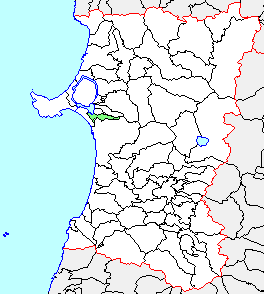
English: Akita Showa
日本語: 秋田県昭和町、県内位置図 |
||
| Source | File:Japan map.png | ||
| Author |
|
||
| Permission (Reusing this file) |
|
Licensing edit

|
Permission is granted to copy, distribute and/or modify this document under the terms of the GNU Free Documentation License, Version 1.2 or any later version published by the Free Software Foundation; with no Invariant Sections, no Front-Cover Texts, and no Back-Cover Texts. A copy of the license is included in the section entitled GNU Free Documentation License. |
- You are free:
- to share – to copy, distribute and transmit the work
- to remix – to adapt the work
- Under the following conditions:
- attribution – You must give appropriate credit, provide a link to the license, and indicate if changes were made. You may do so in any reasonable manner, but not in any way that suggests the licensor endorses you or your use.
- share alike – If you remix, transform, or build upon the material, you must distribute your contributions under the same or compatible license as the original.
Original upload log edit
- 2004-09-20 18:13 Koba-chan 264×294× (5560 bytes) 秋田県昭和町、市町村境界図。海岸線を青色。田沢湖・八郎潟調整池を加筆
- 2003-12-16 15:41 Koba-chan 264×294× (5375 bytes) 秋田県昭和町、県内位置図
- 2003-12-15 17:30 Koba-chan 264×294× (5262 bytes) 秋田県昭和町、県内位置図
| This file was moved from Japanese Wikipedia.
See below for original file information. | ||||||||||||||||||||||||||||||||||||
| ||||||||||||||||||||||||||||||||||||
|
| ||||||||||||||||||||||||||||||||||||
File history
Click on a date/time to view the file as it appeared at that time.
| Date/Time | Thumbnail | Dimensions | User | Comment | |
|---|---|---|---|---|---|
| current | 20:31, 12 October 2020 | | 264 × 294 (5 KB) | OgreBot (talk | contribs) | (BOT): Reverting to most recent version before archival |
| 20:31, 12 October 2020 |  | 264 × 294 (5 KB) | OgreBot (talk | contribs) | (BOT): Uploading old version of file from ja.wikipedia; originally uploaded on 2003-12-16 15:41:22 by Koba-chan | |
| 20:31, 12 October 2020 |  | 264 × 294 (5 KB) | OgreBot (talk | contribs) | (BOT): Uploading old version of file from ja.wikipedia; originally uploaded on 2003-12-15 17:30:28 by Koba-chan | |
| 09:27, 27 May 2020 |  | 264 × 294 (5 KB) | Ntsctalk (talk | contribs) | Uploaded a work by https://ja.wikipedia.org/wiki/%E5%88%A9%E7%94%A8%E8%80%85:Koba-chan from https://ja.wikipedia.org/wiki/%E3%83%95%E3%82%A1%E3%82%A4%E3%83%AB:Akita_Showa.png with UploadWizard | |
| 18:13, 20 September 2004 |  | 264 × 294 (5 KB) | Koba-chan (talk | contribs) | 秋田県昭和町、市町村境界図。海岸線を青色。田沢湖・八郎潟調整池を加筆 | |
| 15:41, 16 December 2003 |  | 264 × 294 (5 KB) | Koba-chan (talk | contribs) | 秋田県昭和町、県内位置図 | |
| 17:30, 15 December 2003 |  | 264 × 294 (5 KB) | Koba-chan (talk | contribs) | 秋田県昭和町、県内位置図 |
You cannot overwrite this file.
File usage on Commons
There are no pages that use this file.
File usage on other wikis
The following other wikis use this file:
- Usage on en.wikipedia.org
- Usage on ja.wikipedia.org
- Usage on ko.wikipedia.org
- Usage on zh.wikipedia.org