File:Amous.JPG
Size of this preview: 450 × 600 pixels. Other resolutions: 180 × 240 pixels | 360 × 480 pixels | 576 × 768 pixels | 768 × 1,024 pixels | 2,112 × 2,816 pixels.
Original file (2,112 × 2,816 pixels, file size: 4.26 MB, MIME type: image/jpeg)
Captions
Captions
Add a one-line explanation of what this file represents
Summary edit
| Description |
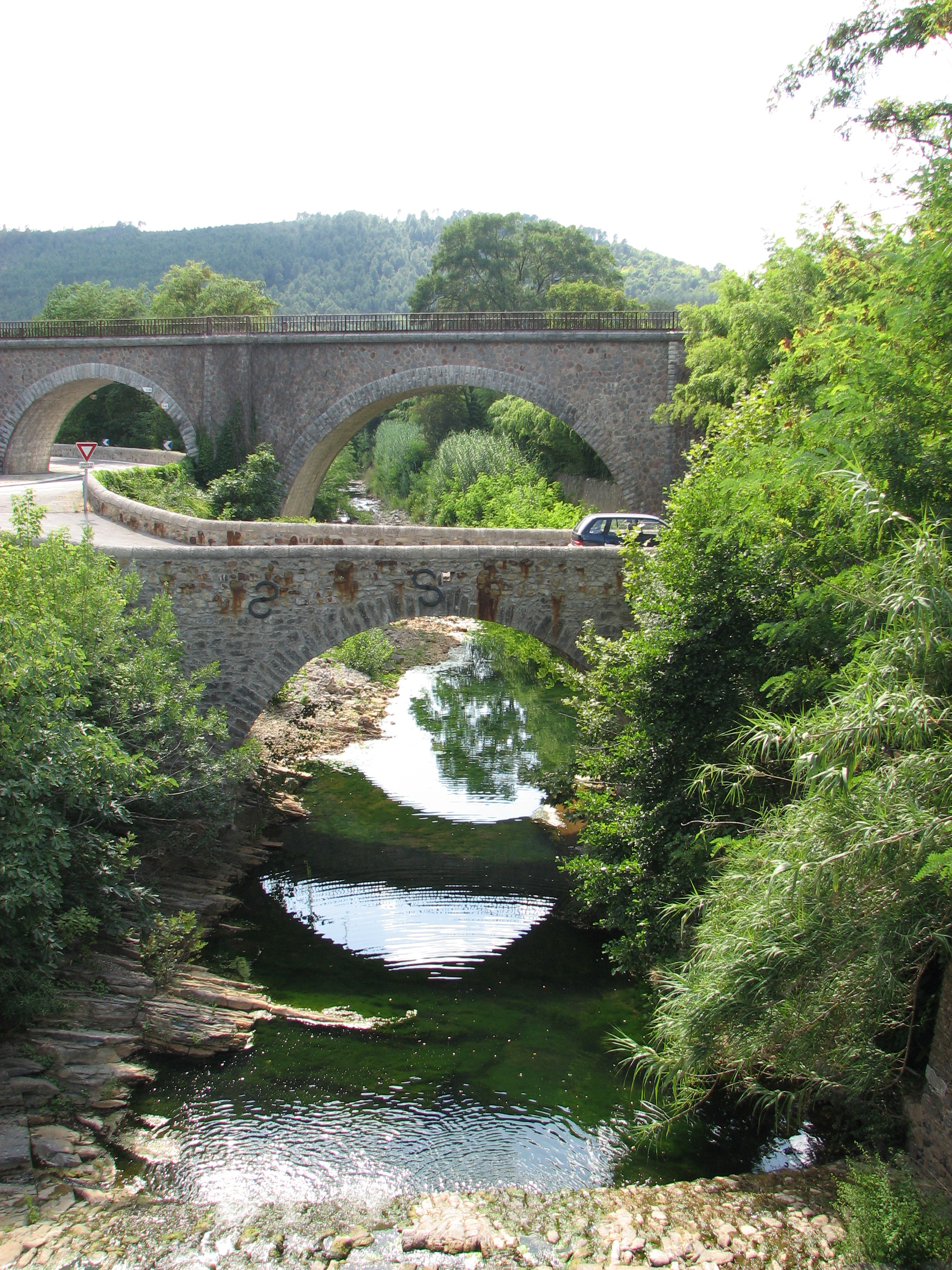
Français : Ponts ferroviaire et routier au-dessus de l'Amous, affluent du Gard ou Gardon. Vue vers l'ouest et vers l'aval, depuis un deuxième pont routier en amont de ces deux ponts. La confluence de l'Amous avec le Gard est à 360 m en aval du pont ferroviaire. Hameau de Maguielle immédiatement à droite de la photo, hameau de Coudoulous à gauche. La bambouseraie d'Anduze, en bordure de l'Amous, est sur la droite derrière le pont de chemin de fer. |
| Date | |
| Source | Own work |
| Author | Stéphane Batigne |
| Camera location | | View this and other nearby images on: OpenStreetMap |
|---|
see http://sandre.eaufrance.fr/app/chainage/courdo/htm/V7140500.php?cg=V7140500
Licensing edit
I, the copyright holder of this work, hereby publish it under the following licenses:

|
Permission is granted to copy, distribute and/or modify this document under the terms of the GNU Free Documentation License, Version 1.2 or any later version published by the Free Software Foundation; with no Invariant Sections, no Front-Cover Texts, and no Back-Cover Texts. A copy of the license is included in the section entitled GNU Free Documentation License. |
This file is licensed under the Creative Commons Attribution 3.0 Unported license.
- You are free:
- to share – to copy, distribute and transmit the work
- to remix – to adapt the work
- Under the following conditions:
- attribution – You must give appropriate credit, provide a link to the license, and indicate if changes were made. You may do so in any reasonable manner, but not in any way that suggests the licensor endorses you or your use.
You may select the license of your choice.
File history
Click on a date/time to view the file as it appeared at that time.
| Date/Time | Thumbnail | Dimensions | User | Comment | |
|---|---|---|---|---|---|
| current | 21:01, 12 June 2023 | | 2,112 × 2,816 (4.26 MB) | SteinsplitterBot (talk | contribs) | Bot: Reset EXIF-specified Orientation of image (EXIF-Orientation set from 81 to 0, rotated 0°) |
| 22:02, 6 August 2009 |  | 2,112 × 2,816 (4.26 MB) | Stéphane Batigne (talk | contribs) | {{Information |Description=Ponts ferroviaire et routier au-dessus de l'Amous, rivière du Gard, en amont d'Anduze |Source=travail personnel |Date=juillet 2009 |Author= Stéphane Batigne |Permission= |other_versions= }} |
You cannot overwrite this file.
File usage on Commons
The following page uses this file:
File usage on other wikis
The following other wikis use this file:
- Usage on da.wikipedia.org
- Usage on es.wikipedia.org
- Usage on fr.wikipedia.org
- Usage on pl.wikipedia.org
- Usage on www.wikidata.org