File:Anjouan Map 1930.jpg
Size of this preview: 800 × 498 pixels. Other resolutions: 320 × 199 pixels | 640 × 398 pixels | 1,024 × 637 pixels | 1,280 × 796 pixels | 1,942 × 1,208 pixels.
Original file (1,942 × 1,208 pixels, file size: 1.32 MB, MIME type: image/jpeg)
Captions
Captions
Add a one-line explanation of what this file represents
Summary edit
| Description |
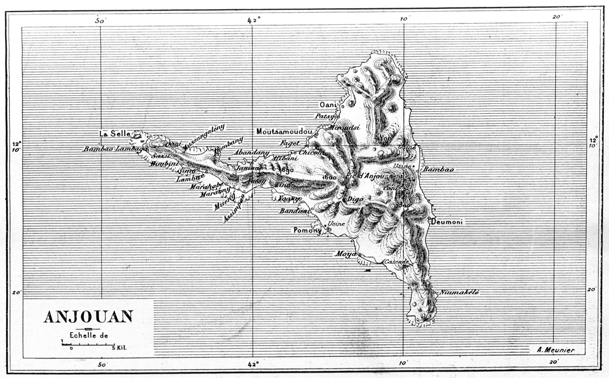
English: Map of Anjouan (Comores) 1900. Deutsch: Karte der Komoreninsel Anjouan, 1900. |
||||
| Date | |||||
| Source |
Notice sur Mayotte et les Comores: Exposition Universelle de 1900 à Paris. Les Colonies françaises Paris 1900 |
||||
| Author | Meunier, Alexandre (*1870) | ||||
| Permission (Reusing this file) |
|
||||
File history
Click on a date/time to view the file as it appeared at that time.
| Date/Time | Thumbnail | Dimensions | User | Comment | |
|---|---|---|---|---|---|
| current | 11:37, 13 July 2021 | | 1,942 × 1,208 (1.32 MB) | Zenwort (talk | contribs) | {{Information |Description={{en|Map of Anjouan (Comores) 1930.}} {{de|Karte der Komoreninsel Anjouan, 1930.}} |Source=Colonies de l'Océan Indien et de l'Océan Pacifique: Côte des Somalis-La Réunion-Établissements français de l'Inde-Établissements français de l'Océanie-Établissements français du Pacifique Austral Paris 1931 |Date=1930 |Author=Meunier, Alexandre (*1870), Société d'Editions Géographiques, Maritimes et Coloniales |Permission={{PD-old-70-1923}} |other_versions= }} |
You cannot overwrite this file.
File usage on Commons
There are no pages that use this file.