File:Atlas of Vesta (PIA17480).tif

Size of this JPG preview of this TIF file: 800 × 411 pixels. Other resolutions: 320 × 164 pixels | 640 × 329 pixels | 1,024 × 526 pixels | 1,280 × 658 pixels | 2,362 × 1,214 pixels.
Original file (2,362 × 1,214 pixels, file size: 1.67 MB, MIME type: image/tiff)
Captions
Captions
Add a one-line explanation of what this file represents
Summary edit
| Description |
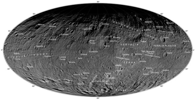
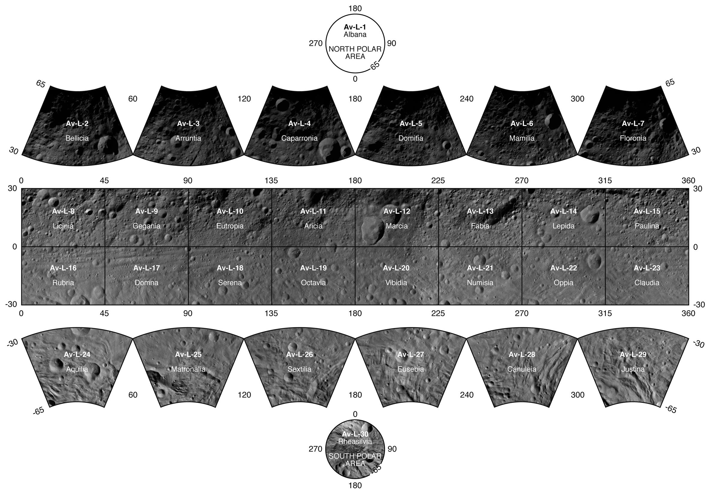
English: This atlas of the giant asteroid Vesta was created from images taken as NASA's Dawn mission flew around the object, also known as a protoplanet. The set of maps was created from mosaics of 10,000 images from Dawn¹s framing camera instrument, taken at a low altitude of about 130 miles (210 kilometers). |
| Date | (published) |
| Source | Catalog page · Full-res (JPEG · TIFF) |
| Author | NASA/JPL-Caltech/UCLA/MPS/DLR/IDA |
This image or video was catalogued by Jet Propulsion Laboratory of the United States National Aeronautics and Space Administration (NASA) under Photo ID: PIA17480. This tag does not indicate the copyright status of the attached work. A normal copyright tag is still required. See Commons:Licensing. Other languages:
|
| This media is a product of the Dawn mission Credit and attribution belongs to the Dawn Framing camera (FC) team, NASA/JPL-Caltech/UCLA/MPS/DLR/IDA |
Licensing edit
| This file is in the public domain in the United States because it was solely created by NASA. NASA copyright policy states that "NASA material is not protected by copyright unless noted". (See Template:PD-USGov, NASA copyright policy page or JPL Image Use Policy.) | ||
 |
Warnings:
|
File history
Click on a date/time to view the file as it appeared at that time.
| Date/Time | Thumbnail | Dimensions | User | Comment | |
|---|---|---|---|---|---|
| current | 04:57, 13 December 2019 |  | 2,362 × 1,214 (1.67 MB) | Huntster (talk | contribs) | =={{int:filedesc}}== {{NASA Photojournal | catalog = PIA17480 | image = yes | mission = Dawn | instrument = Framing Camera | caption = {{en|1=This atlas of the giant asteroid Vesta was created from images taken as NASA's Dawn mission flew around the object, also known as a protoplanet. The set of maps was created from mosaics of 10,000 images from Dawn¹s framing camera instrument, taken at a low altitude of about 130 miles (210 kilometers).}} | credit = NAS... |
You cannot overwrite this file.
File usage on Commons
The following page uses this file:
File usage on other wikis
The following other wikis use this file:
- Usage on en.wikiversity.org