File:BalizeMap1723.jpeg
No higher resolution available.
BalizeMap1723.jpeg (595 × 468 pixels, file size: 115 KB, MIME type: image/jpeg)
Captions
Captions
Add a one-line explanation of what this file represents
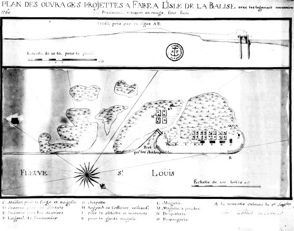
| Description | 1723 map of La Balize shown, by the mouth of the Mississippi. | ||||
| Date | |||||
| Source | 18th century map via Louisiana State Museum site at [1] | ||||
| Author | Not credited | ||||
| Permission (Reusing this file) |
|
||||
File history
Click on a date/time to view the file as it appeared at that time.
| Date/Time | Thumbnail | Dimensions | User | Comment | |
|---|---|---|---|---|---|
| current | 04:42, 7 September 2009 | | 595 × 468 (115 KB) | Infrogmation (talk | contribs) | {{Information |Description= 1723 map of La Balize shown, by the mouth of the Mississippi. |Source= 18th century map via Louisiana State Museum site at [http://louisdl.louislibraries.org/cdm4/item_viewer.php?CISOROOT=/LSA&CISOPTR=320&CISOBOX=1&REC=7] |Da |
You cannot overwrite this file.
File usage on Commons
There are no pages that use this file.