File:Bayonne-Pont Mayou-1900.jpg
Size of this preview: 800 × 410 pixels. Other resolutions: 320 × 164 pixels | 640 × 328 pixels | 1,417 × 726 pixels.
Original file (1,417 × 726 pixels, file size: 916 KB, MIME type: image/jpeg)
Captions
Captions
Add a one-line explanation of what this file represents
Summary
edit
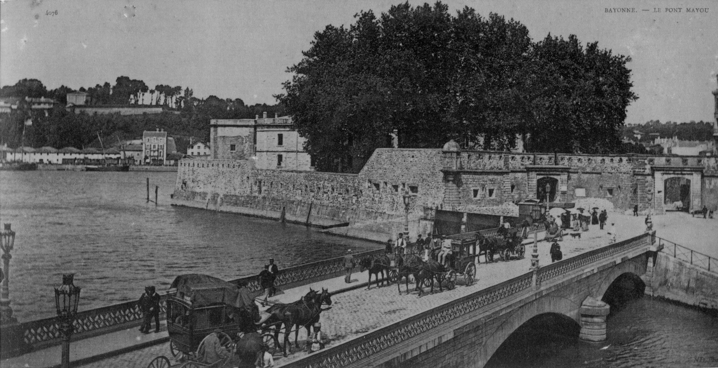
| Description | The Mayou Bridge, rebuilt in stone in 1857, using the "platform foundation" technique also used for the Saint-Esprit Bridge in 1884. | |||
| Date | circa 1900 | |||
| Source | Personal collection of Daniel VILLAFRUELA | |||
| Author |
|
|||
| Permission (Reusing this file) |
|
| Camera location | | View this and other nearby images on: OpenStreetMap |
|---|
[[Category:Pont Mayou, Bayonne|Mayou
File history
Click on a date/time to view the file as it appeared at that time.
| Date/Time | Thumbnail | Dimensions | User | Comment | |
|---|---|---|---|---|---|
| current | 09:40, 4 January 2022 | | 1,417 × 726 (916 KB) | Daniel VILLAFRUELA (talk | contribs) | <!-- Add your traduction at the multilingual descriptor {{mld}} or {{LangSwitch}} used in this page--> {{Information |description={{LangSwitch |en= The Mayou Bridge, rebuilt in stone in 1857, using the "platform foundation" technique also used for the Saint-Esprit Bridge in 1884 |es= El puente Mayou, reconstruido en piedra en 1857, con la técnica de „cimientos sobre plataform“, que también se utilizó para el puente de Saint-Esprit en 1884 |fr= Le pont Mayou, reconstruit en pierre en 1... |
You cannot overwrite this file.
File usage on Commons
The following 2 pages use this file: