File:Bayonne-Rue Port Neuf-1900.jpg
Size of this preview: 800 × 534 pixels. Other resolutions: 320 × 213 pixels | 640 × 427 pixels | 1,024 × 683 pixels | 1,417 × 945 pixels.
Original file (1,417 × 945 pixels, file size: 2 MB, MIME type: image/jpeg)
Captions
Captions
Add a one-line explanation of what this file represents
Summary
edit
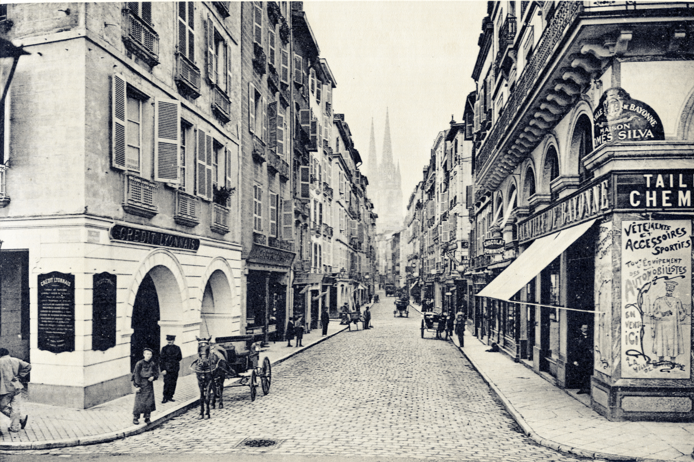
| Description | The “Rue Port Neuf” was once a port, as evidenced by the arches where goods were stored before being unloaded and put away in the storerooms that became nowa shops. | |||
| Date | circa 1900 | |||
| Source | Personal collection of Daniel VILLAFRUELA | |||
| Author |
|
|||
| Permission (Reusing this file) |
|
| Camera location | | View this and other nearby images on: OpenStreetMap |
|---|
File history
Click on a date/time to view the file as it appeared at that time.
| Date/Time | Thumbnail | Dimensions | User | Comment | |
|---|---|---|---|---|---|
| current | 10:47, 10 January 2022 | | 1,417 × 945 (2 MB) | Daniel VILLAFRUELA (talk | contribs) | == {{int:filedesc}} == <!-- Add your traduction at the multilingual descriptor {{mld}} or {{LangSwitch}} used in this page--> {{Information |description={{LangSwitch |en= The “Rue Port Neuf” was once a port, as evidenced by the arches where goods were stored before being unloaded and put away in the storerooms that became nowa shops. |es= La „calle Port Neuf“ fue en su día un puerto, como demuestran los arcos donde se almacenaban las mercancías antes de guardarlas en los cobertizos que s... |
You cannot overwrite this file.
File usage on Commons
The following page uses this file: