File:Bend, Oregon (1290860413).jpg
Original file (1,200 × 1,600 pixels, file size: 200 KB, MIME type: image/jpeg)
Captions
Captions
Summary edit
.jpg&action=edit§ion=1)
| Description |
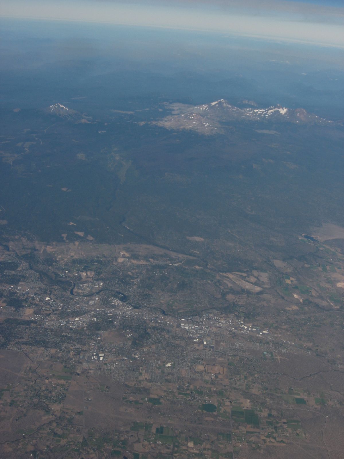
Bend is a city in and the county seat of Deschutes County, Oregon, United States. It is the principal city of the Bend, Oregon Metropolitan Statistical Area. Bend is Central Oregon's largest city, and despite its modest size, is the de facto metropolis of the region, owing to the low population density of that area. Bend recorded a population of 76,693 at the time of the 2010 US Census, up from 52,029 at the 2000 census. The estimated population of the city as of 2013 is 81,236. Bend's metro population was estimated at 165,954 as of July 1, 2013. The Bend MSA is the fifth largest metropolitan area in Oregon. Bend is located on the eastern edge of the Cascade Range along the Deschutes River. Here the Ponderosa Pine forest transitions into the high desert, characterized by arid land, junipers, sagebrush, and bitter-brush. Originally a crossing point on the river, settlement began in the early 1900s. Bend was incorporated as a city in 1905. Economically, it started as a logging town but is now identified as a gateway for many outdoor sports, including mountain biking, fishing, hiking, camping, rock climbing, white-water rafting, skiing, paragliding and golf. Inside the city limits is Pilot Butte State Scenic Viewpoint, an old cinder cone. Bend is one of three cities in the continental U.S. (with Portland, Oregon and Jackson, Mississippi) to have an extinct volcano within its city limits. Just south of Bend is Newberry National Volcanic Monument on U.S. Route 97. Tourism is one of Bend's largest sectors. The Mount Bachelor ski resort brings in tourists from all over Oregon, Washington, and California. The nearby Cascade Lakes are also a large draw for tourists. Recreational activities include downhill and cross country skiing, hiking, biking, rafting, golfing, camping, fishing, picnicking, rock climbing, and general sightseeing. Much of Bend's rapid growth in recent years is also due to its attraction as a retirement destination. en.wikipedia.org/wiki/Bend,_Oregon en.wikipedia.org/wiki/Wikipedia:Text_of_Creative_Commons_... |
| Date | |
| Source | Bend, Oregon |
| Author | Ken Lund from Reno, Nevada, USA |
| Camera location | | View this and other nearby images on: OpenStreetMap |
|---|
.jpg¶ms=044.060175_N_-121.307258_E_globe:Earth_type:camera_source:Flickr_&language=en)
Licensing edit
.jpg&action=edit§ion=2)
- You are free:
- to share – to copy, distribute and transmit the work
- to remix – to adapt the work
- Under the following conditions:
- attribution – You must give appropriate credit, provide a link to the license, and indicate if changes were made. You may do so in any reasonable manner, but not in any way that suggests the licensor endorses you or your use.
- share alike – If you remix, transform, or build upon the material, you must distribute your contributions under the same or compatible license as the original.
| This image was originally posted to Flickr by Ken Lund at https://flickr.com/photos/75683070@N00/1290860413. It was reviewed on 3 December 2015 by FlickreviewR and was confirmed to be licensed under the terms of the cc-by-sa-2.0. |
File history
Click on a date/time to view the file as it appeared at that time.
| Date/Time | Thumbnail | Dimensions | User | Comment | |
|---|---|---|---|---|---|
| current | 21:55, 3 December 2015 | | 1,200 × 1,600 (200 KB) | INeverCry (talk | contribs) | Transferred from Flickr via Flickr2Commons |
You cannot overwrite this file.
File usage on Commons
There are no pages that use this file.
.jpg&oldid=821020416)