File:Big Devil Peak 8704s.JPG

Size of this preview: 800 × 533 pixels. Other resolutions: 320 × 213 pixels | 640 × 427 pixels | 1,024 × 683 pixels | 1,280 × 853 pixels | 2,560 × 1,706 pixels | 4,244 × 2,829 pixels.
Original file (4,244 × 2,829 pixels, file size: 4.86 MB, MIME type: image/jpeg)
Captions
Captions
Add a one-line explanation of what this file represents
Summary edit
| Description |
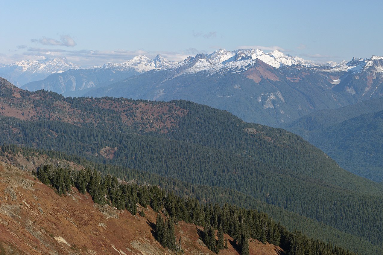
English: Big Devil Peak (right center middle distance with large brown southwest slope); The Trapezoid (center middle distance behind and left of Big Devil); The Needle (just right of Big Devil on skyline); Snowfield Peak (right center skyline, partially cloud-shrouded); Baksit Peak (6960+ feet, far right skyline); Cats Ear (skyline between The Trapezoid and Big Devil); Paul Bunyans Stump (with flat top, left skyline); Pinnacle Peak (left of Paul Bunyans Stump)
|
| Date | 28 October 2013, 20:43:35 +00:00 |
| Source | Own work |
| Author | Walter Siegmund (talk) |
| Other versions |
|


| Camera location | | View this and other nearby images on: OpenStreetMap |
|---|
| Camera Model | Canon EOS DIGITAL REBEL XSi |
|---|---|
| Shutter speed | 1/200 |
| Aperture | f/11.0 |
| Film speed (ISO) | 400 |
| Focal length | 100.0 |
| Filter(s) | Hoya Circular Polarizer, HOCPMC67 |

|
This image is the work of Walter Siegmund
|
Licensing edit
I, the copyright holder of this work, hereby publish it under the following license:
This file is licensed under the Creative Commons Attribution-Share Alike 3.0 Unported license.
- You are free:
- to share – to copy, distribute and transmit the work
- to remix – to adapt the work
- Under the following conditions:
- attribution – You must give appropriate credit, provide a link to the license, and indicate if changes were made. You may do so in any reasonable manner, but not in any way that suggests the licensor endorses you or your use.
- share alike – If you remix, transform, or build upon the material, you must distribute your contributions under the same or compatible license as the original.
File history
Click on a date/time to view the file as it appeared at that time.
| Date/Time | Thumbnail | Dimensions | User | Comment | |
|---|---|---|---|---|---|
| current | 21:05, 14 January 2015 | | 4,244 × 2,829 (4.86 MB) | Wsiegmund (talk | contribs) |
You cannot overwrite this file.
File usage on Commons
The following 7 pages use this file: