File:Big Thuja plicata - Olympic National Park.jpg
Original file (2,229 × 3,343 pixels, file size: 6.13 MB, MIME type: image/jpeg)
Captions
Captions
| Description |
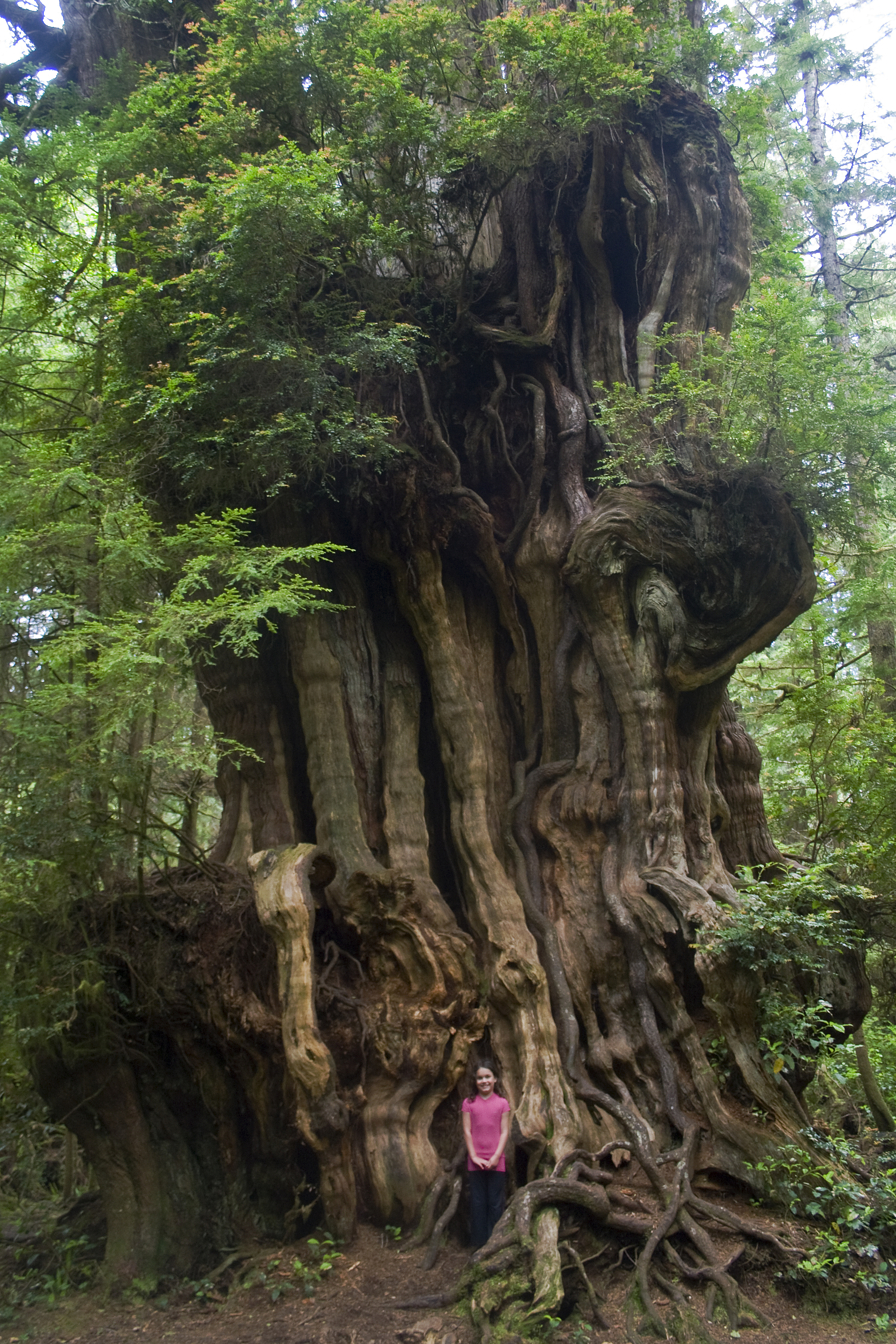
This mind-blowing tree is located in Washington’s Olympic National Forest about five miles north of Kaloloch lodge just off highway 101. Don’t let the understated "Big Cedar Tree" moniker lead you to bypass this treasure. There are lots of "big" redcedars in the park, but this one has enough gnarly character to be the oldest Ent (Treebeard) in Lord of the Rings the Two Towers. The tree is also called the Kalaloch Cedar. National park service sign: Big Cedar Western redcedar has been the art and sinew of coastal Indian village life. The trunk is house plank and ocean-going canoe; branches are harpoon line; outer bark is diaper and bandage; inner bark is basket, clothing and mattress. Tree size expresses climate – heavy annual rainfall, and the nourishing damp of ocean fog. In a scramble for growing space other tree species are using the cedar as a standing nurselog. Latitude/Longitude 48° 05.83' N 123° 24.36' W (Note: These coordinates are in Port Angeles, Washington, which is not near the described location.) It is among the most widespread trees in the Pacific Northwest, and is associated with Douglas-fir and western hemlock in most places where it grows. In addition to growing in lush forests, western redcedar is also a riparian tree, and grows in many forested swamps and streambanks in its range. The tree is shade-tolerant, and able to reproduce under dense shade. Western redcedar is also known (mainly in the American horticultural trade) as Giant Arborvitae. The name western redcedar is also sometimes split into three words as 'Western Red Cedar', though this can cause confusion, as it is not a cedar. [via wikipedia; 2008.07.01] |
||
| Date | |||
| Source | originally posted to Flickr as Big Cedar Tree, (tiny girl) Olympic National Park | ||
| Author | woodley wonderworks | ||
| Permission (Reusing this file) |
This file is licensed under the Creative Commons Attribution 2.0 Generic license.
|
| Camera location | | View this and other nearby images on: OpenStreetMap |
|---|
File history
Click on a date/time to view the file as it appeared at that time.
| Date/Time | Thumbnail | Dimensions | User | Comment | |
|---|---|---|---|---|---|
| current | 21:02, 27 September 2008 | | 2,229 × 3,343 (6.13 MB) | Flickr upload bot (talk | contribs) | Uploaded from http://flickr.com/photo/73645804@N00/2626561293 using Flickr upload bot |
You cannot overwrite this file.
File usage on Commons
The following 4 pages use this file:
File usage on other wikis
The following other wikis use this file: