File:Biscayne National Park Map 2009.png

Size of this preview: 528 × 600 pixels. Other resolutions: 211 × 240 pixels | 423 × 480 pixels | 676 × 768 pixels | 902 × 1,024 pixels | 1,803 × 2,048 pixels | 3,391 × 3,851 pixels.
Original file (3,391 × 3,851 pixels, file size: 487 KB, MIME type: image/png)
Captions
Captions
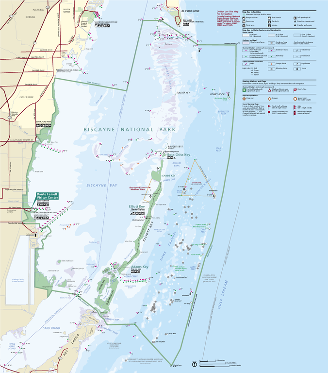
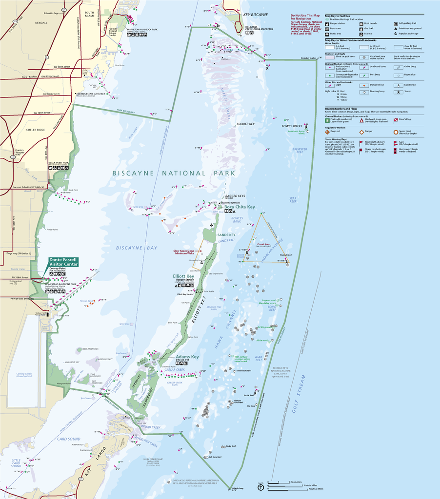
Official National Park Service map of Biscayne National Park, Florida
Summary edit
| Description |
English: Official National Park Service map of Biscayne National Park, Official National Park Service map of Biscayne National Park, Florida. Converted from PDF using Adobe Acrobat X Professional. Original file name:
BISCmap1.pdfFrançais : Carte officielle du parc national Biscayne en Floride |
| Date | |
| Source | http://hfc.nps.gov/carto/PDF/BISCmap1.pdf |
| Author | National Park Service, Harpers Ferry Center |
Licensing edit
| This image or media file contains material based on a work of a National Park Service employee, created as part of that person's official duties. As a work of the U.S. federal government, such work is in the public domain in the United States. See the NPS website and NPS copyright policy for more information. |
File history
Click on a date/time to view the file as it appeared at that time.
| Date/Time | Thumbnail | Dimensions | User | Comment | |
|---|---|---|---|---|---|
| current | 19:39, 19 November 2012 | | 3,391 × 3,851 (487 KB) | Acroterion (talk | contribs) | {{Information |Description ={{en|1=Official National Park Service map of Everglades National Park, Official National Park Service map of [[:en:Everglades Na... |
You cannot overwrite this file.
File usage on Commons
The following page uses this file:
File usage on other wikis
The following other wikis use this file:
- Usage on de.wikipedia.org
- Usage on en.wikipedia.org
- Usage on en.wikivoyage.org
- Usage on es.wikipedia.org
- Usage on eu.wikipedia.org
- Usage on he.wikipedia.org
- Usage on it.wikipedia.org
- Usage on ru.wikipedia.org
- Usage on tr.wikipedia.org
- Usage on zh.wikipedia.org