File:Biurman södra Stockholm 1751.jpg

Size of this preview: 800 × 572 pixels. Other resolutions: 320 × 229 pixels | 640 × 458 pixels | 1,024 × 732 pixels | 1,280 × 915 pixels | 2,098 × 1,500 pixels.
Original file (2,098 × 1,500 pixels, file size: 1.27 MB, MIME type: image/jpeg)
Captions
Captions
Add a one-line explanation of what this file represents
Summary
edit
| Description |
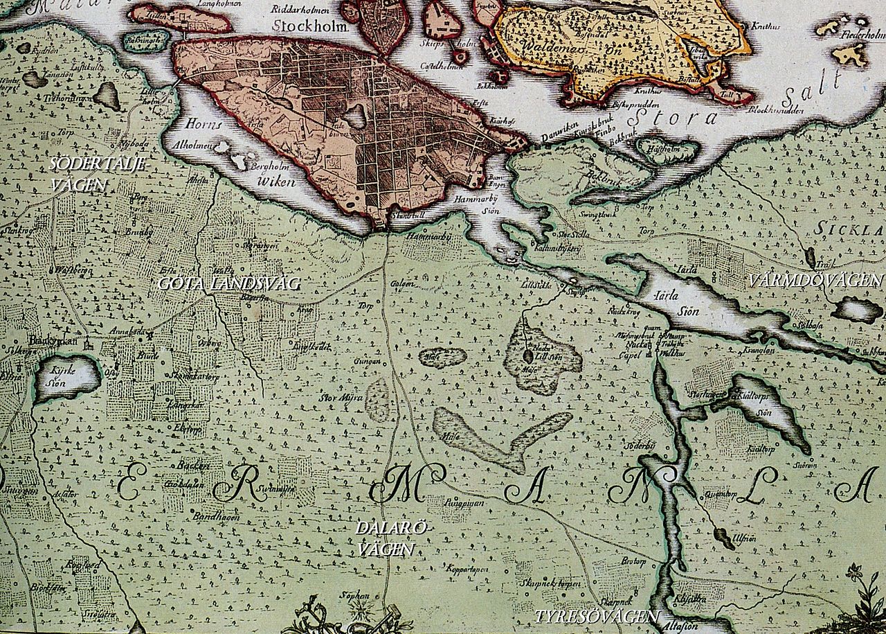
English: Historical map showing Stockholm, in the 18th century. The map is produced by Georg Biurman about 1750-51. This image shows a part of south Stockholm with "Södertäljevägen", "Göta landsväg", "Tyresövägen", "Värmdövägen" and "Dalarövägen" |
| Date | |
| Source | Stockholms stadsarkiv |
| Author | Georg Biurman |
Licensing
edit
|
This work is in the public domain in its country of origin and other countries and areas where the copyright term is the author's life plus 100 years or fewer. | |
| This file has been identified as being free of known restrictions under copyright law, including all related and neighboring rights. | |
File history
Click on a date/time to view the file as it appeared at that time.
| Date/Time | Thumbnail | Dimensions | User | Comment | |
|---|---|---|---|---|---|
| current | 09:21, 20 April 2012 | | 2,098 × 1,500 (1.27 MB) | Holger.Ellgaard (talk | contribs) | + Tyresövägen + Värmdövägen |
| 08:48, 20 April 2012 |  | 2,098 × 1,500 (1.27 MB) | Holger.Ellgaard (talk | contribs) |
You cannot overwrite this file.
File usage on Commons
There are no pages that use this file.
File usage on other wikis
The following other wikis use this file:
- Usage on sv.wikipedia.org