File:Bludenz-Muttersbergbahn-lower station-01ASD.jpg

Size of this preview: 800 × 532 pixels. Other resolutions: 320 × 213 pixels | 640 × 426 pixels | 1,024 × 681 pixels | 1,280 × 852 pixels | 2,560 × 1,704 pixels | 4,592 × 3,056 pixels.
Original file (4,592 × 3,056 pixels, file size: 8.59 MB, MIME type: image/jpeg)
Captions
Captions
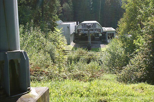
Gondola to the Muttersberg (mountain)
Summary
edit
| Description |
Deutsch: Seilbahn auf den Muttersberg. Talstation in der Gemeinde Bludenz (678 m.ü.M.), Bergstation in der Gemeinde Nüziders (1397 m.ü.M:).
English: Gondola to the Muttersberg (mountain). Valley station in the community of Bludenz (on 678 masl), mountain station in the community of Nüziders (about 1397 masl).
Français : Téléphérique vers le Muttersberg (montagne). Station aval dans la commune de Bludenz (678 m d'altitude), station amont dans la commune de Nüziders (environ 1397 m d'altitude). |
| Date | |
| Source | Own work |
| Author | Asurnipal |
| Camera location | | View this and other nearby images on: OpenStreetMap |
|---|
Licensing
edit
I, the copyright holder of this work, hereby publish it under the following license:
This file is licensed under the Creative Commons Attribution-Share Alike 4.0 International license.
- You are free:
- to share – to copy, distribute and transmit the work
- to remix – to adapt the work
- Under the following conditions:
- attribution – You must give appropriate credit, provide a link to the license, and indicate if changes were made. You may do so in any reasonable manner, but not in any way that suggests the licensor endorses you or your use.
- share alike – If you remix, transform, or build upon the material, you must distribute your contributions under the same or compatible license as the original.
File history
Click on a date/time to view the file as it appeared at that time.
| Date/Time | Thumbnail | Dimensions | User | Comment | |
|---|---|---|---|---|---|
| current | 16:25, 1 October 2020 | | 4,592 × 3,056 (8.59 MB) | Asurnipal (talk | contribs) | Uploaded own work with UploadWizard |
You cannot overwrite this file.
File usage on Commons
The following page uses this file: