File:Britain 886.jpg
Size of this preview: 424 × 600 pixels. Other resolutions: 170 × 240 pixels | 339 × 480 pixels | 543 × 768 pixels | 1,241 × 1,755 pixels.
Original file (1,241 × 1,755 pixels, file size: 474 KB, MIME type: image/jpeg)
Captions
Captions
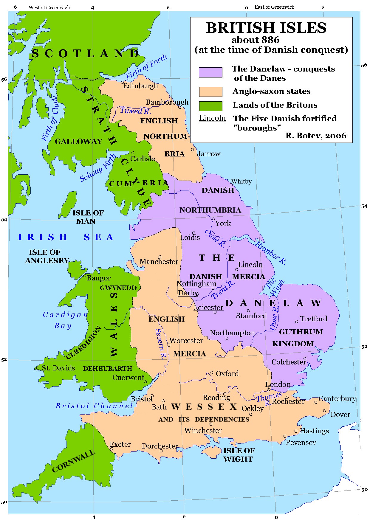
Map of the British Isles around 886.
Изработено от Потребител:Lotroo ...
| This work has been released into the public domain by its author, Lotroo. This applies worldwide. In some countries this may not be legally possible; if so: |
File history
Click on a date/time to view the file as it appeared at that time.
| Date/Time | Thumbnail | Dimensions | User | Comment | |
|---|---|---|---|---|---|
| current | 02:08, 31 May 2022 | | 1,241 × 1,755 (474 KB) | Bodrugan (talk | contribs) | Correcting western border of Wessex for 886, and spellings of Whitby and Northumbria, some layout of region names |
| 09:50, 25 August 2006 |  | 1,241 × 1,755 (681 KB) | Lotroo~commonswiki (talk | contribs) | Category:Maps of the history of BritainИзработено от Потребител:Lotroo ... {{PD-user|Lotroo}} |
You cannot overwrite this file.
File usage on Commons
The following 2 pages use this file:
File usage on other wikis
The following other wikis use this file:
- Usage on arz.wikipedia.org
- Usage on br.wikipedia.org
- Usage on ca.wikipedia.org
- Usage on el.wikipedia.org
- Usage on en.wikipedia.org
- Usage on es.wikipedia.org
- Usage on fr.wikipedia.org
- Usage on fr.wiktionary.org
- Usage on gl.wikipedia.org
- Usage on incubator.wikimedia.org
- Usage on it.wikipedia.org
- Usage on lt.wikipedia.org
- Usage on lv.wikipedia.org
- Usage on mn.wikipedia.org
- Usage on ru.wikipedia.org
- Usage on sl.wikipedia.org
- Usage on th.wikipedia.org
- Usage on uk.wikipedia.org