File:California map showing Riverside County.png
No higher resolution available.
California_map_showing_Riverside_County.png (200 × 231 pixels, file size: 22 KB, MIME type: image/png)
Captions
Captions
Add a one-line explanation of what this file represents
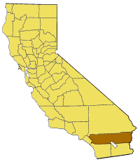
Map of Riverside county in California. From en:

|
Permission is granted to copy, distribute and/or modify this document under the terms of the GNU Free Documentation License, Version 1.2 or any later version published by the Free Software Foundation; with no Invariant Sections, no Front-Cover Texts, and no Back-Cover Texts. A copy of the license is included in the section entitled GNU Free Documentation License. |
| This file is licensed under the Creative Commons Attribution-Share Alike 3.0 Unported license. | ||
| ||
| This licensing tag was added to this file as part of the GFDL licensing update. |
File history
Click on a date/time to view the file as it appeared at that time.
| Date/Time | Thumbnail | Dimensions | User | Comment | |
|---|---|---|---|---|---|
| current | 15:23, 14 July 2005 | | 200 × 231 (22 KB) | Pyramide~commonswiki (talk | contribs) | Map of Riverside county in California. From en: {{GFDL}} Category:Maps of counties in California |
You cannot overwrite this file.
File usage on Commons
The following 15 pages use this file:
- Category:Births in Riverside County, California
- Category:Deaths in Riverside County, California
- Category:Economy of Riverside County, California
- Category:Education in Riverside County, California
- Category:Energy in Riverside County, California
- Category:Geography of Riverside County, California
- Category:Geology of Riverside County, California
- Category:History of Riverside County, California
- Category:Maps of Riverside County, California
- Category:Military in Riverside County, California
- Category:Mountains of Riverside County, California
- Category:Nature of Riverside County, California
- Category:People of Riverside County, California
- Category:Riverside County, California
- Category:Roads in Riverside County, California
File usage on other wikis
The following other wikis use this file:
- Usage on ar.wikipedia.org
- Usage on arz.wikipedia.org
- Usage on az.wikipedia.org
- Usage on be.wikipedia.org
- Usage on bg.wikipedia.org
- Usage on ca.wikipedia.org
- Usage on ceb.wikipedia.org
- Usage on ce.wikipedia.org
- Usage on cy.wikipedia.org
- Usage on el.wikipedia.org
- Usage on en.wikipedia.org
- Low Desert
- Cucamonga Valley
- Little San Bernardino Mountains
- James Reserve
- Salton Sea State Recreation Area
- La Quinta Resort & Club
- Indio Hills Palms
- Cahuilla County, California
- Coxcomb Mountains
- Eagle Mountains
- Pinto Mountains
- Little Maria Mountains
- Mule Mountains (California)
- Mojave and Colorado Deserts Biosphere Reserve
- Hexie Mountains
- San Gorgonio River
- Prado Reservoir
- Template:RiversideCountyCA-geo-stub
- North Palm Springs, California
- Vail Lake
- Reinhardt Canyon
- Midland, California
- Temecula Valley
- Eureka Peak (California)
- Valerie Jean Dates
- Pinyon Pines, California
- Salt Creek (Salton Sea)
- Chino Canyon (California)
- Chino Fault
- Black Hills (Riverside County)
- Cottonwood Mountains (Riverside County)
- Domenigoni Mountains
- Indio Hills
- Jurupa Mountains
- Kalmia Hills
- Little Chuckwalla Mountains
- Pedley Hills
- Rawson Mountains (California)
- Santa Rosa Hills (Riverside County)
- The Badlands (California)
View more global usage of this file.