File:Cameroon - Landsat 7.jpg

Size of this preview: 800 × 600 pixels. Other resolutions: 320 × 240 pixels | 640 × 480 pixels | 1,024 × 768 pixels | 1,280 × 960 pixels | 2,560 × 1,920 pixels.
Original file (2,560 × 1,920 pixels, file size: 1.09 MB, MIME type: image/jpeg)
Captions
Captions
Add a one-line explanation of what this file represents
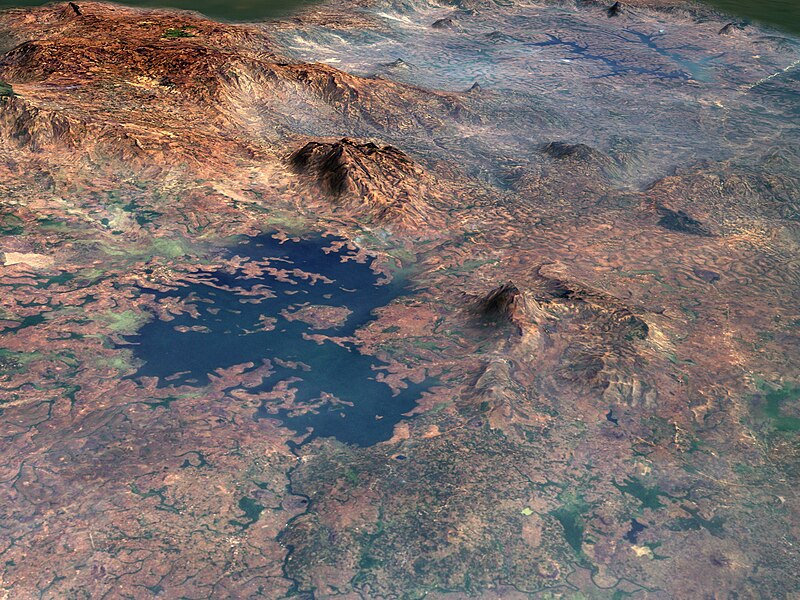
| Description | Bamenjing Reservoir, Cameroon, Africa on 2-5-2001 taken by Landsat-7 | ||
| Date | |||
| Source | originally posted to Flickr as Cameroon | ||
| Author | NASA Goddard Space Flight Center | ||
| Permission (Reusing this file) |
This file is licensed under the Creative Commons Attribution 2.0 Generic license.
|
File history
Click on a date/time to view the file as it appeared at that time.
| Date/Time | Thumbnail | Dimensions | User | Comment | |
|---|---|---|---|---|---|
| current | 00:36, 26 July 2010 | | 2,560 × 1,920 (1.09 MB) | Flickr upload bot (talk | contribs) | Uploaded from http://flickr.com/photo/24662369@N07/4691434810 using Flickr upload bot |
You cannot overwrite this file.
File usage on Commons
The following 2 pages use this file:
File usage on other wikis
The following other wikis use this file:
- Usage on ceb.wikipedia.org
- Usage on de.wikipedia.org
- Usage on fr.wikipedia.org
- Usage on nl.wikipedia.org
- Usage on www.wikidata.org
- Usage on zh-min-nan.wikipedia.org