File:Carmel.svg

Size of this PNG preview of this SVG file: 800 × 518 pixels. Other resolutions: 320 × 207 pixels | 640 × 414 pixels | 1,024 × 663 pixels | 1,280 × 829 pixels | 2,560 × 1,658 pixels | 2,100 × 1,360 pixels.
Original file (SVG file, nominally 2,100 × 1,360 pixels, file size: 125 KB)
Captions
Captions
Add a one-line explanation of what this file represents
Summary edit
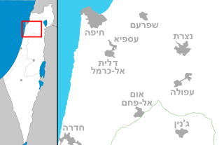
| Description | Map of Mt. Carmel area (Israel) |
| Date | (UTC) |
| Source | Own work |
| Author | Costello |
Licensing edit
I, the copyright holder of this work, hereby publish it under the following licenses:

|
Permission is granted to copy, distribute and/or modify this document under the terms of the GNU Free Documentation License, Version 1.2 or any later version published by the Free Software Foundation; with no Invariant Sections, no Front-Cover Texts, and no Back-Cover Texts. A copy of the license is included in the section entitled GNU Free Documentation License. |
This file is licensed under the Creative Commons Attribution-Share Alike 4.0 International, 3.0 Unported, 2.5 Generic, 2.0 Generic and 1.0 Generic license.
- You are free:
- to share – to copy, distribute and transmit the work
- to remix – to adapt the work
- Under the following conditions:
- attribution – You must give appropriate credit, provide a link to the license, and indicate if changes were made. You may do so in any reasonable manner, but not in any way that suggests the licensor endorses you or your use.
- share alike – If you remix, transform, or build upon the material, you must distribute your contributions under the same or compatible license as the original.
You may select the license of your choice.
File history
Click on a date/time to view the file as it appeared at that time.
| Date/Time | Thumbnail | Dimensions | User | Comment | |
|---|---|---|---|---|---|
| current | 19:26, 29 November 2023 | | 2,100 × 1,360 (125 KB) | רונאלדיניו המלך (talk | contribs) | הסרת קו לפי [https://he.wikipedia.org/w/index.php?title=%D7%95%D7%99%D7%A7%D7%99%D7%A4%D7%93%D7%99%D7%94:%D7%A1%D7%93%D7%A0%D7%94_%D7%9C%D7%92%D7%A8%D7%A4%D7%99%D7%A7%D7%94&diff=prev&oldid=36404045] |
| 17:21, 21 February 2017 |  | 2,100 × 1,360 (127 KB) | קרלוס הגדול (talk | contribs) | . | |
| 07:28, 6 August 2010 |  | 2,100 × 1,360 (127 KB) | Setreset (talk | contribs) | דליה ועספיה | |
| 23:56, 31 July 2010 |  | 2,100 × 1,360 (122 KB) | Ori~ (talk | contribs) | Reverted to version as of 16:07, 2 October 2008 | |
| 04:24, 27 July 2010 |  | 2,100 × 1,360 (115 KB) | Ori~ (talk | contribs) | קג | |
| 16:07, 2 October 2008 |  | 2,100 × 1,360 (122 KB) | Costello (talk | contribs) | fix of the Dead sea south border | |
| 11:01, 23 May 2008 |  | 2,100 × 1,360 (123 KB) | Costello (talk | contribs) | == Summary == {{Information |Description=Map of Mt. Carmel area (Israel) |Source=Own work |Date=~~~~~ |Author=Costello |Permission= |other_versions= }} Category:SVG maps of Israel == Licensing == {{self|GFDL|cc-by-sa-all}} |
You cannot overwrite this file.
File usage on Commons
The following page uses this file:
File usage on other wikis
The following other wikis use this file:
- Usage on en.wikipedia.org
- Usage on he.wikipedia.org
- ג'נין
- נצרת
- גבעת עוז
- ברקאי
- גן שמואל
- דליה (קיבוץ)
- הזורע
- אום אל-פחם
- אור עקיבא
- חדרה
- מגדל העמק
- עפולה
- בנימינה-גבעת עדה
- בסמ"ה
- ג'סר א-זרקא
- דלית אל-כרמל
- זכרון יעקב
- יפיע
- יקנעם עילית
- כפר קרע
- מעלה עירון
- ערערה
- עתלית
- פוריידיס
- פרדס חנה-כרכור
- חריש (עיר)
- רמת ישי
- קיסריה
- מזרע
- בית שערים
- תמרת
- בסיס רמת דוד
- עין אילה
- שדה יעקב
- מגידו (קיבוץ)
- תל מגידו
- רמת הנדיב
- רמת השופט
- משמר העמק
- נהלל
- יקנעם (מושבה)
- קרן הכרמל
- שדות ים
- גן השומרון
- נווה ים
- עמק יזרעאל
- מועצה אזורית עמק יזרעאל
- עין הוד
- הכרמל
View more global usage of this file.