File:Colombia Topography.png
Size of this preview: 459 × 599 pixels. Other resolutions: 184 × 240 pixels | 368 × 480 pixels | 589 × 768 pixels | 785 × 1,024 pixels | 1,839 × 2,399 pixels.
Original file (1,839 × 2,399 pixels, file size: 2.98 MB, MIME type: image/png)
Captions
Captions
Add a one-line explanation of what this file represents
Summary
edit
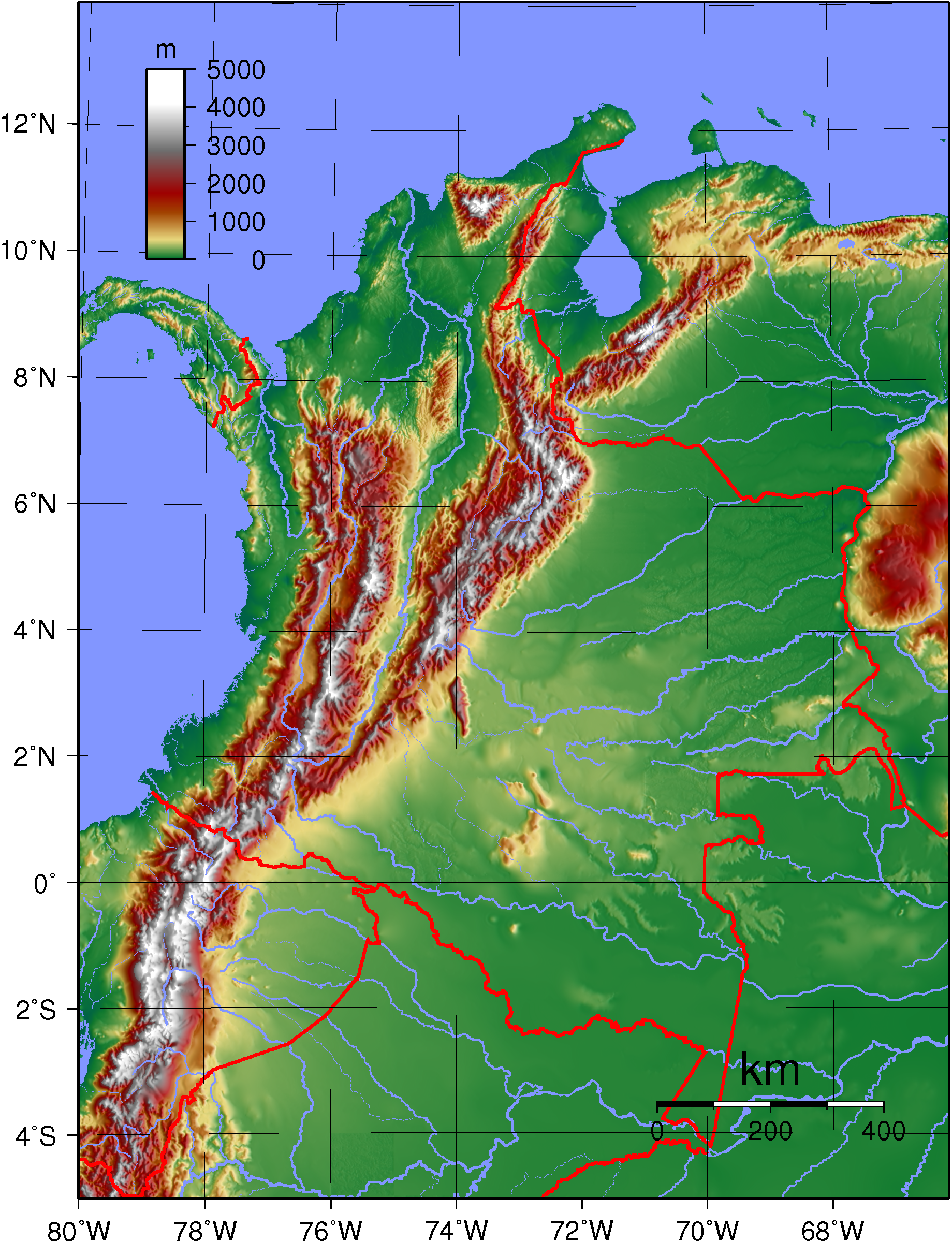
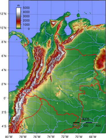
| Description | Topographic map of Colombia. Created with GMT from publicly released GLOBE data.[1] |
| Date | |
| Source | Own work |
| Author | Sadalmelik |
| Other versions | Derivative works of this file: Colombia Topography 2.png |
Licensing
edit
| This work has been released into the public domain by its author, I, Sadalmelik. This applies worldwide. In some countries this may not be legally possible; if so: I, Sadalmelik grants anyone the right to use this work for any purpose, without any conditions, unless such conditions are required by law. |
File history
Click on a date/time to view the file as it appeared at that time.
| Date/Time | Thumbnail | Dimensions | User | Comment | |
|---|---|---|---|---|---|
| current | 20:49, 11 June 2007 | | 1,839 × 2,399 (2.98 MB) | Sadalmelik (talk | contribs) | {{Information |Description=Topographic map of Colombia. Created with GMT from publicly released GLOBE data.[http://www.ngdc.noaa.gov/mgg/topo/globe.html] |Source=self-made |Date=June 11, 2007 |Author= Sadalmelik }} [[Category:Maps of |
You cannot overwrite this file.
File usage on Commons
The following 2 pages use this file:
File usage on other wikis
The following other wikis use this file:
- Usage on br.wikipedia.org
- Usage on en.wikipedia.org
- Usage on eo.wikipedia.org
- Usage on es.wikipedia.org
- Usage on fr.wikipedia.org
- Usage on ja.wikipedia.org
- Usage on ka.wikipedia.org
- Usage on la.wikipedia.org
- Usage on lt.wikipedia.org
- Usage on nl.wikipedia.org
- Usage on pl.wikipedia.org
- Usage on pt.wikipedia.org
- Usage on ro.wikipedia.org
- Usage on vep.wikipedia.org
- Usage on vi.wikipedia.org
- Usage on zh.wikipedia.org