File:Construction site between Sherbourne Commons and the Parliament Slip, A, 2013 10 05 (1)--(22).tif

Size of this PNG preview of this TIF file: 800 × 252 pixels. Other resolutions: 320 × 101 pixels | 640 × 202 pixels | 1,024 × 323 pixels | 1,280 × 403 pixels | 2,560 × 807 pixels | 6,582 × 2,074 pixels.
Original file (6,582 × 2,074 pixels, file size: 40.46 MB, MIME type: image/tiff)
Captions
Captions
Add a one-line explanation of what this file represents
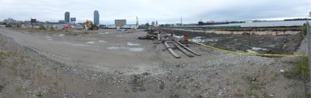
| Description | Construction site between Sherbourne Commons and the Parliament Slip. | ||
| Date | Taken on 5 October 2013 | ||
| Source | Own work | ||
| Author | Geo Swan (talk) | ||
| Permission (Reusing this file) |
|
| Camera location | | View this and other nearby images on: OpenStreetMap |
|---|
| Annotations | This image is annotated: View the annotations at Commons |
File history
Click on a date/time to view the file as it appeared at that time.
| Date/Time | Thumbnail | Dimensions | User | Comment | |
|---|---|---|---|---|---|
| current | 16:54, 7 October 2013 | 6,582 × 2,074 (40.46 MB) | Geo Swan (talk | contribs) | {{Information | Description = Construction site between Sherbourne Commons and the Parliament Slip. | Source = {{own}} | Date = 2013-10-05 | Author = ~~~ | Permission = {{PD-Self}} }} {{GPS EXIF}} Category:Toronto Waterfront [[Cat... |
You cannot overwrite this file.
File usage on Commons
There are no pages that use this file.