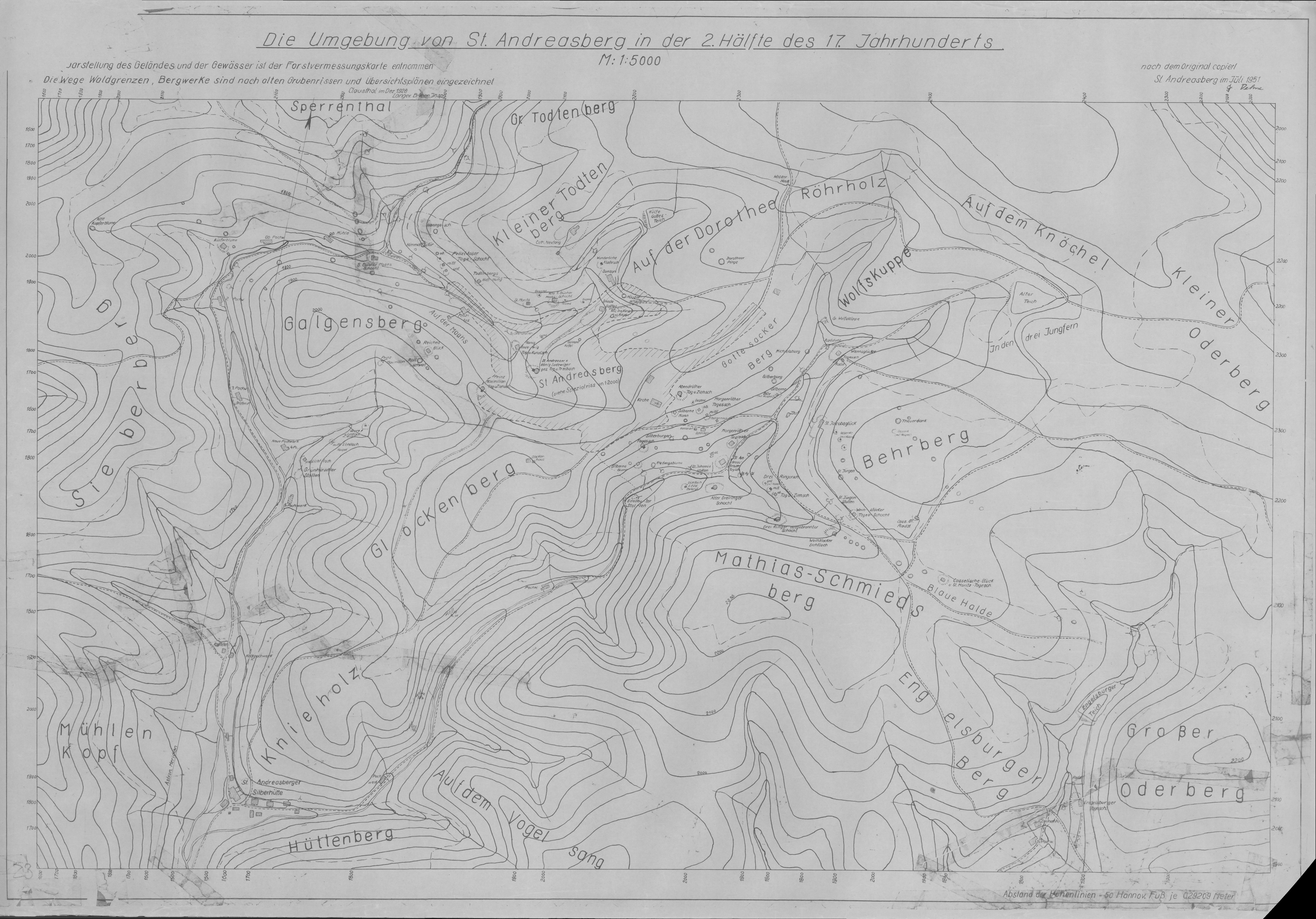
File:Die Umgebung von St. Andreasberg in der 2. Hälfte des 17. Jahrhunderts.jpg
Size of this preview: 800 × 559 pixels. Other resolutions: 320 × 223 pixels | 640 × 447 pixels | 1,024 × 715 pixels | 1,280 × 894 pixels | 2,560 × 1,788 pixels | 7,072 × 4,938 pixels.
Original file (7,072 × 4,938 pixels, file size: 6.47 MB, MIME type: image/jpeg)
Captions
Captions
Add a one-line explanation of what this file represents
Summary edit
Licensing edit
|
This work is in the public domain in its country of origin and other countries and areas where the copyright term is the author's life plus 70 years or fewer. This work is in the public domain in the United States because it was published (or registered with the U.S. Copyright Office) before January 1, 1929. | |
| This file has been identified as being free of known restrictions under copyright law, including all related and neighboring rights. | |
File history
Click on a date/time to view the file as it appeared at that time.
| Date/Time | Thumbnail | Dimensions | User | Comment | |
|---|---|---|---|---|---|
| current | 14:06, 23 August 2015 | | 7,072 × 4,938 (6.47 MB) | Ogmios (talk | contribs) | User created page with UploadWizard |
You cannot overwrite this file.
File usage on Commons
The following page uses this file:
File usage on other wikis
The following other wikis use this file:
- Usage on de.wikipedia.org
- Usage on www.wikidata.org