File:Duisburg, Schwafheimer Bruch, 2010-12 CN-02.jpg
Size of this preview: 800 × 552 pixels. Other resolutions: 320 × 221 pixels | 640 × 441 pixels | 1,024 × 706 pixels | 1,280 × 883 pixels | 2,900 × 2,000 pixels.
Original file (2,900 × 2,000 pixels, file size: 4.2 MB, MIME type: image/jpeg)
Captions
Captions
Add a one-line explanation of what this file represents
Summary edit
| Description |
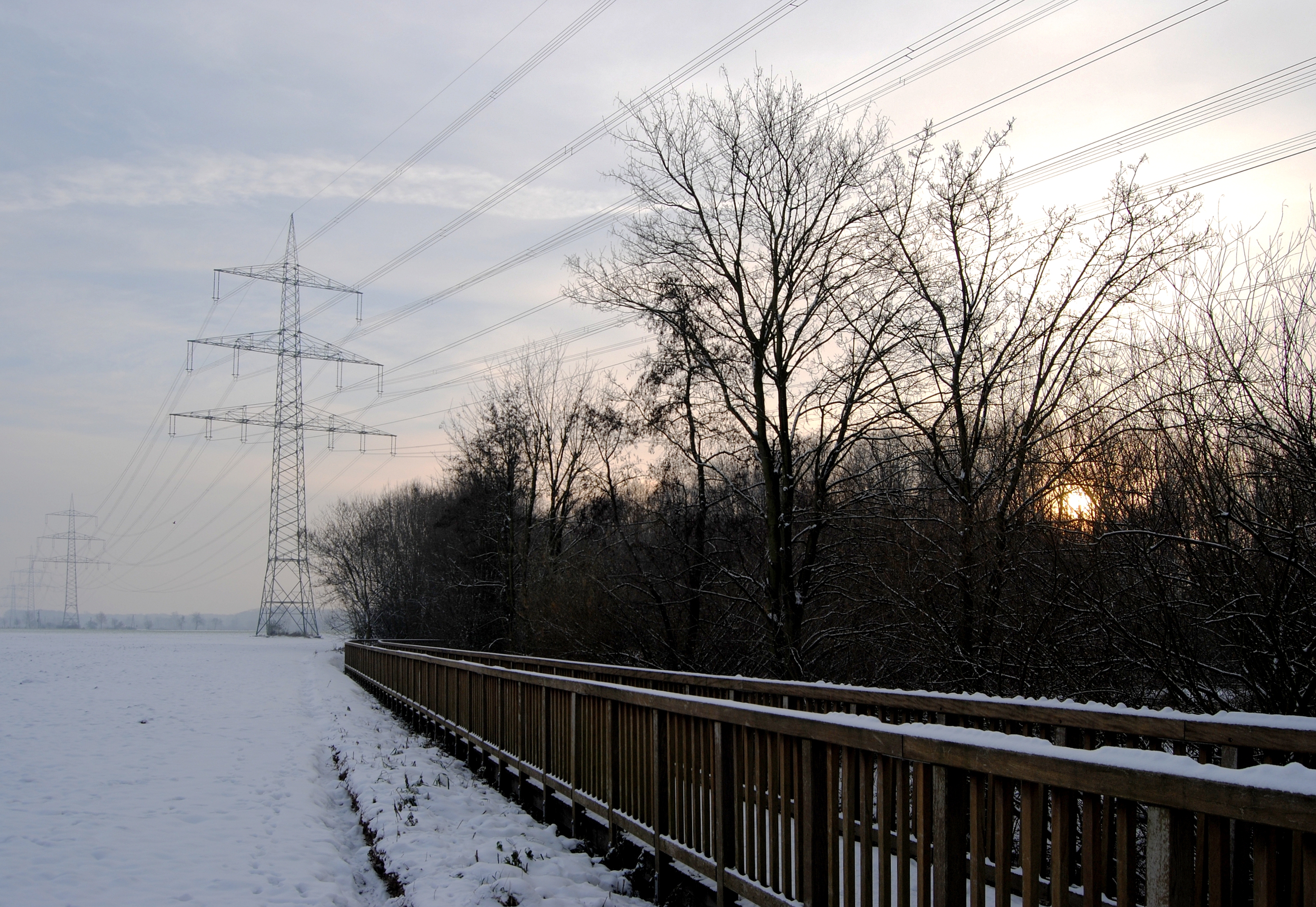
This file was uploaded with Commonist. Deutsch: Die Holzbrücke am Schwafheimer Meer entlang der Stadtgrenze zwischen Duisburg (links) und Moers (rechts), Nordrhein-Westfalen, an einem schneebedeckten späten Nachmittag. Abgebildeter Bereich links im Duisburger Landschaftsschutzgebiet „Landwirtschaftliche Bereiche Mühlenwinkel, Buschkamp, Kleine Bloedt, Waldgebiet Waldborn“; rechts Randbereich NSG „Schwafheimer Bruch“ (Moers). Freileitungsmast (Bl. 4577 M12, 380/220 kV)
English: The wooden bridge at the Schwafheimer Meer on the border between Duisburg (left) and Moers (right), North Rhine-Westphalia, Germany, late in a snowy December afternoon. |
| Date | |
| Source | Own work |
| Author | kaʁstn Disk/Cat |
| Camera location | | View this and other nearby images on: OpenStreetMap |
|---|
Licensing edit
This file is licensed under the Creative Commons Attribution-Share Alike 3.0 Germany license.
- You are free:
- to share – to copy, distribute and transmit the work
- to remix – to adapt the work
- Under the following conditions:
- attribution – You must give appropriate credit, provide a link to the license, and indicate if changes were made. You may do so in any reasonable manner, but not in any way that suggests the licensor endorses you or your use.
- share alike – If you remix, transform, or build upon the material, you must distribute your contributions under the same or compatible license as the original.

File history
Click on a date/time to view the file as it appeared at that time.
| Date/Time | Thumbnail | Dimensions | User | Comment | |
|---|---|---|---|---|---|
| current | 14:48, 9 December 2010 | | 2,900 × 2,000 (4.2 MB) | Carschten (talk | contribs) |
You cannot overwrite this file.
File usage on Commons
The following 3 pages use this file: