File:EPA map of the Kalamazoo River - final state approved.pdf

Size of this JPG preview of this PDF file: 800 × 518 pixels. Other resolutions: 320 × 207 pixels | 640 × 414 pixels | 1,024 × 663 pixels | 1,280 × 828 pixels | 2,550 × 1,650 pixels.
Original file (2,550 × 1,650 pixels, file size: 992 KB, MIME type: application/pdf)
Captions
Captions
Add a one-line explanation of what this file represents
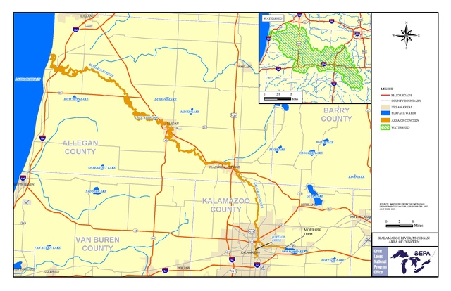
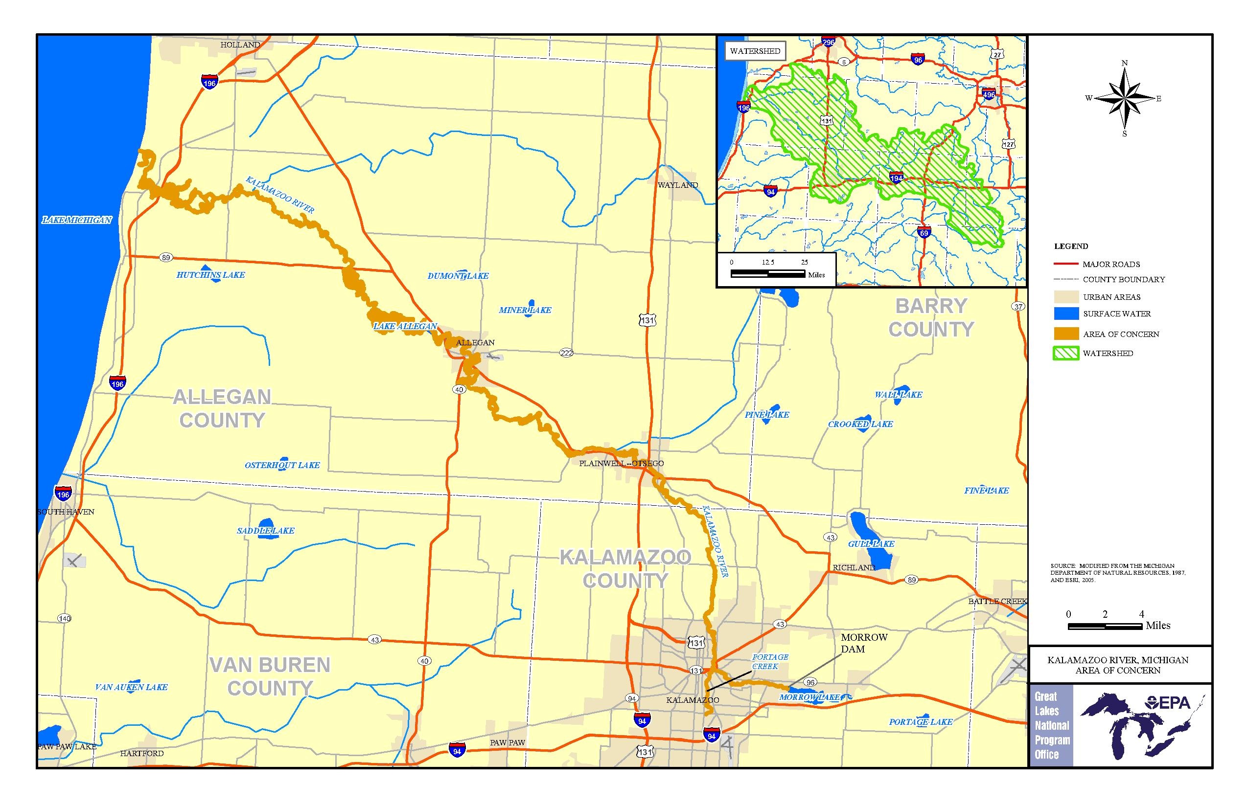
| Description | EPA map of the Kalamazoo River. | |||||
| Source | https://www.epa.gov/kalamazoo-river-aoc/kalamazoo-river-aoc-boundary-map | |||||
| Author | EPA | |||||
| Permission (Reusing this file) |
|
File history
Click on a date/time to view the file as it appeared at that time.
| Date/Time | Thumbnail | Dimensions | User | Comment | |
|---|---|---|---|---|---|
| current | 19:43, 15 August 2016 |  | 2,550 × 1,650 (992 KB) | Geo Swan (talk | contribs) | {{Information |Description=EPA map of the Kalamazoo River. |Source=https://www.epa.gov/kalamazoo-river-aoc/kalamazoo-river-aoc-boundary-map |Date= |Author= EPA |Permission={{PD-USGov-EPA}} |other_versions= }} Category:Kalamazoo River |
You cannot overwrite this file.
File usage on Commons
There are no pages that use this file.