File:Estado de Minas Gerais 1930.pdf

Size of this JPG preview of this PDF file: 713 × 599 pixels. Other resolutions: 286 × 240 pixels | 571 × 480 pixels | 914 × 768 pixels | 1,218 × 1,024 pixels | 2,436 × 2,048 pixels | 5,991 × 5,037 pixels.
Original file (5,991 × 5,037 pixels, file size: 8.71 MB, MIME type: application/pdf)
Captions
Captions
Add a one-line explanation of what this file represents
Summary edit
| Description |
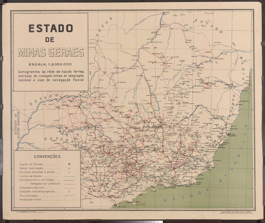
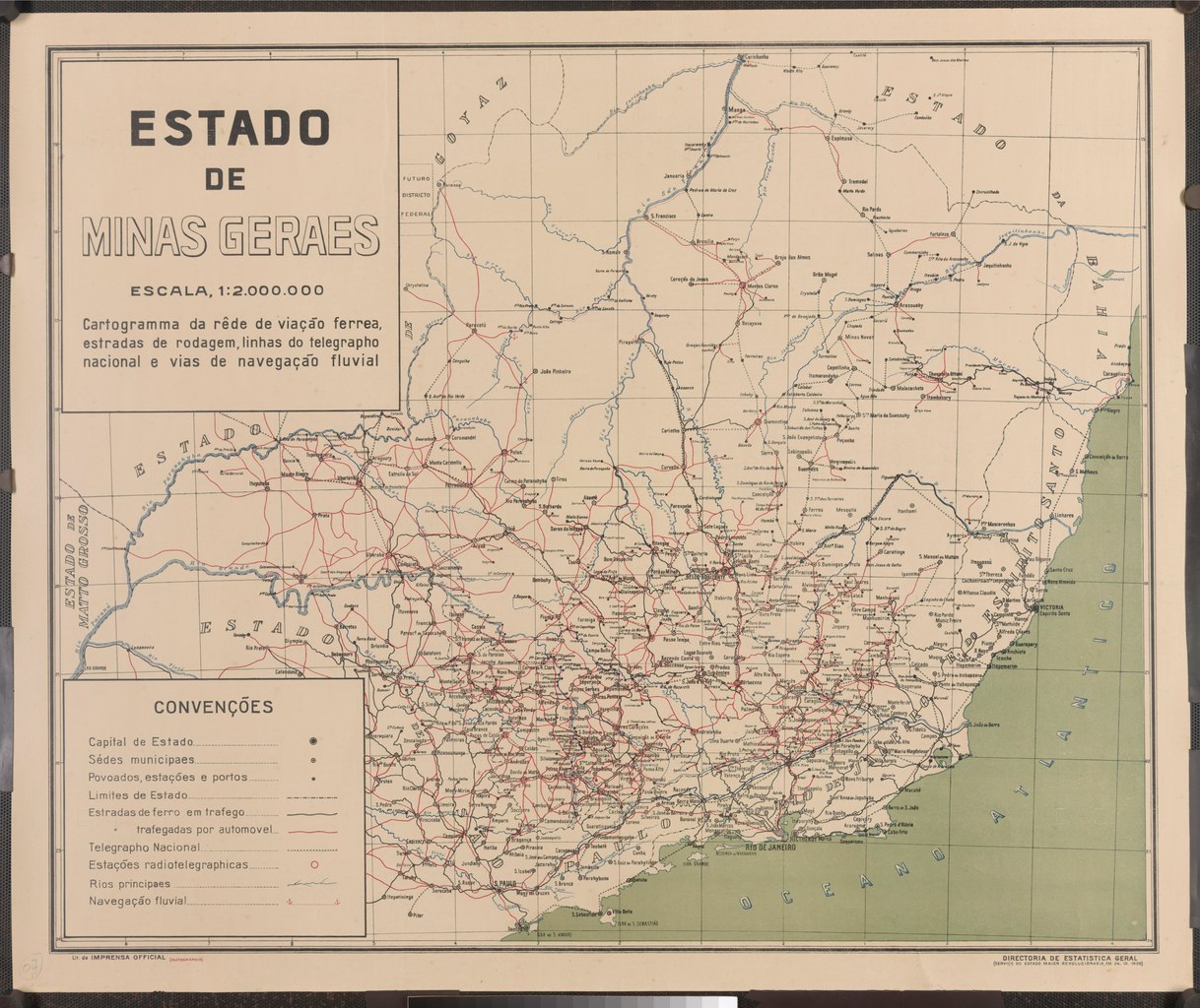
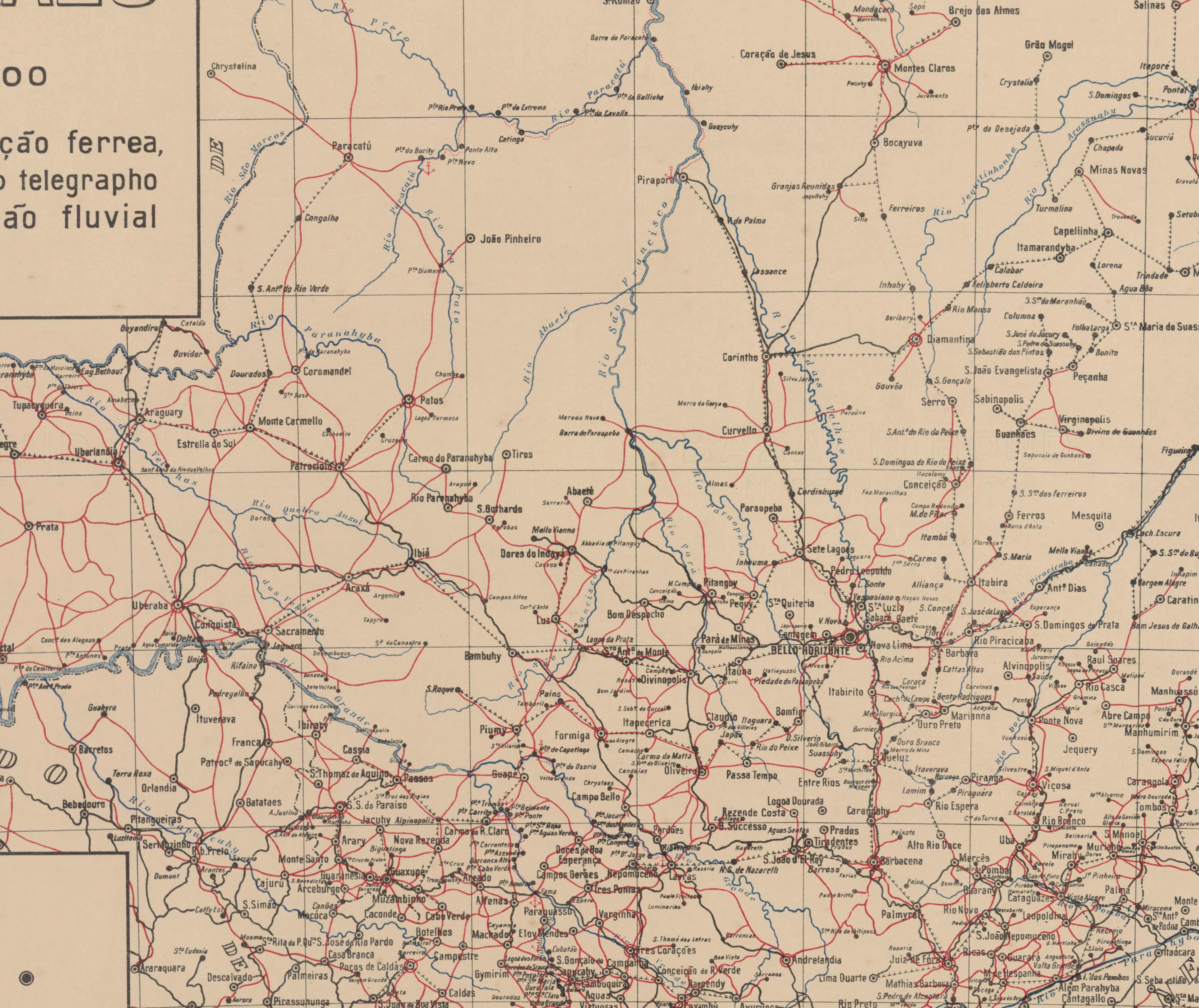
Estado de Minas Gerais: cartograma da rede de viação férrea, estradas de rodagem, linhas do telégrafo nacional e vias de navegação fluvial |
||||||||||||||||||||||||||
| Date | 24 October 1930 | ||||||||||||||||||||||||||
| Collection |
|
||||||||||||||||||||||||||
| Accession number |
BR RJANRIO DS.0.MAP.15 |
||||||||||||||||||||||||||
| Source/Photographer | Arquivo Nacional | ||||||||||||||||||||||||||

Licensing edit
This media is a faithful reproduction of public domain multimedia and it was the result of a GLAM partnership between the Arquivo Nacional and the Wikimedia Users Group in Brazil. The Arquivo Nacional (in English: The Brazilian National Archives) is an institution of the Brazilian Ministry of Justice and Public Security responsible for the management and preservation of documents pertaining to the federal public administration and located in the city of Rio de Janeiro.
Please attribute as: Public domain / Arquivo Nacional Collection Por favor, atribua como: Domínio público / Acervo Arquivo Nacional |
This work is in the public domain in Brazil for one of the following reasons:
|
 |
File history
Click on a date/time to view the file as it appeared at that time.
| Date/Time | Thumbnail | Dimensions | User | Comment | |
|---|---|---|---|---|---|
| current | 15:49, 14 October 2021 |  | 5,991 × 5,037 (8.71 MB) | ALeoncio (WMB) (talk | contribs) | {{Artwork |artist = |author = |title = |description = Estado de Minas Gerais: cartograma da rede de viação férrea, estradas de rodagem, linhas do telégrafo nacional e vias de navegação fluvial |date = 24/10/1930 |medium = |dimensions = |institution = {{Institution:Arquivo Nacional}} |department = |place of discovery = |object history = |exhibition history = |credit line = |inscriptions = |notes = |accession number = BR RJANRIO DS.0.MAP.15 |place of creation = |s... |
You cannot overwrite this file.
File usage on Commons
The following page uses this file: