File:Euskal Herriko herrialdeen mapa.svg

Size of this PNG preview of this SVG file: 659 × 600 pixels. Other resolutions: 264 × 240 pixels | 527 × 480 pixels | 844 × 768 pixels | 1,125 × 1,024 pixels | 2,250 × 2,048 pixels | 735 × 669 pixels.
Original file (SVG file, nominally 735 × 669 pixels, file size: 58 KB)
Captions
Captions
Add a one-line explanation of what this file represents
Summary edit
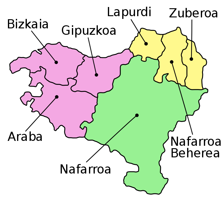
| Description |
Euskara: Euskal Herriko herrialdeen mapa |
| Date | |
| Source | http://commons.wikimedia.org/wiki/Image:Mapa_provincias_Euskal_Herria.svg |
| Author | Unai Fdz. de Betoño, based on User:Willtron |
| Other versions |
|
| SVG development |

Licensing edit
This file is licensed under the Creative Commons Attribution-Share Alike 1.0 Generic license.
- You are free:
- to share – to copy, distribute and transmit the work
- to remix – to adapt the work
- Under the following conditions:
- attribution – You must give appropriate credit, provide a link to the license, and indicate if changes were made. You may do so in any reasonable manner, but not in any way that suggests the licensor endorses you or your use.
- share alike – If you alter, transform, or build upon this work, you must distribute the resulting work under the same license as the original.
File history
Click on a date/time to view the file as it appeared at that time.
| Date/Time | Thumbnail | Dimensions | User | Comment | |
|---|---|---|---|---|---|
| current | 17:24, 18 October 2008 | | 735 × 669 (58 KB) | Unai Fdz. de Betoño (talk | contribs) | {{Information |Description={{eu|1=Euskal Herriko herrialdeen mapa}} |Source=http://commons.wikimedia.org/wiki/Image:Mapa_provincias_Euskal_Herria.svg |Author=Unai Fdz. de Betoño, based on User:Willtron |Date=2008ko urria |
You cannot overwrite this file.
File usage on Commons
The following 5 pages use this file:
File usage on other wikis
The following other wikis use this file:
- Usage on af.wikipedia.org
- Usage on ar.wikipedia.org
- Usage on ary.wikipedia.org
- Usage on ast.wikipedia.org
- Usage on br.wikipedia.org
- Usage on ca.wikipedia.org
- Usage on cy.wikipedia.org
- Usage on de.wikipedia.org
- Usage on de.wiktionary.org
- Usage on et.wikipedia.org
- Usage on eu.wikipedia.org
- Usage on eu.wikiquote.org
- Usage on frp.wikipedia.org
- Usage on fr.wikinews.org
- Usage on gl.wikipedia.org
- Usage on hu.wikipedia.org
- Usage on hy.wikipedia.org
- Usage on ia.wikipedia.org
- Usage on it.wikipedia.org
- Usage on ja.wikipedia.org
- Usage on kab.wikipedia.org
- Usage on ko.wikipedia.org
- Usage on ku.wikipedia.org
- Usage on la.wikipedia.org
View more global usage of this file.