File:Faltung 18 by Marianne Maderna, Horn 04.jpg

Size of this preview: 800 × 549 pixels. Other resolutions: 320 × 220 pixels | 640 × 439 pixels | 1,024 × 703 pixels | 1,280 × 879 pixels | 2,560 × 1,757 pixels | 4,367 × 2,998 pixels.
Original file (4,367 × 2,998 pixels, file size: 6.71 MB, MIME type: image/jpeg)
Captions
Captions
Add a one-line explanation of what this file represents
Summary
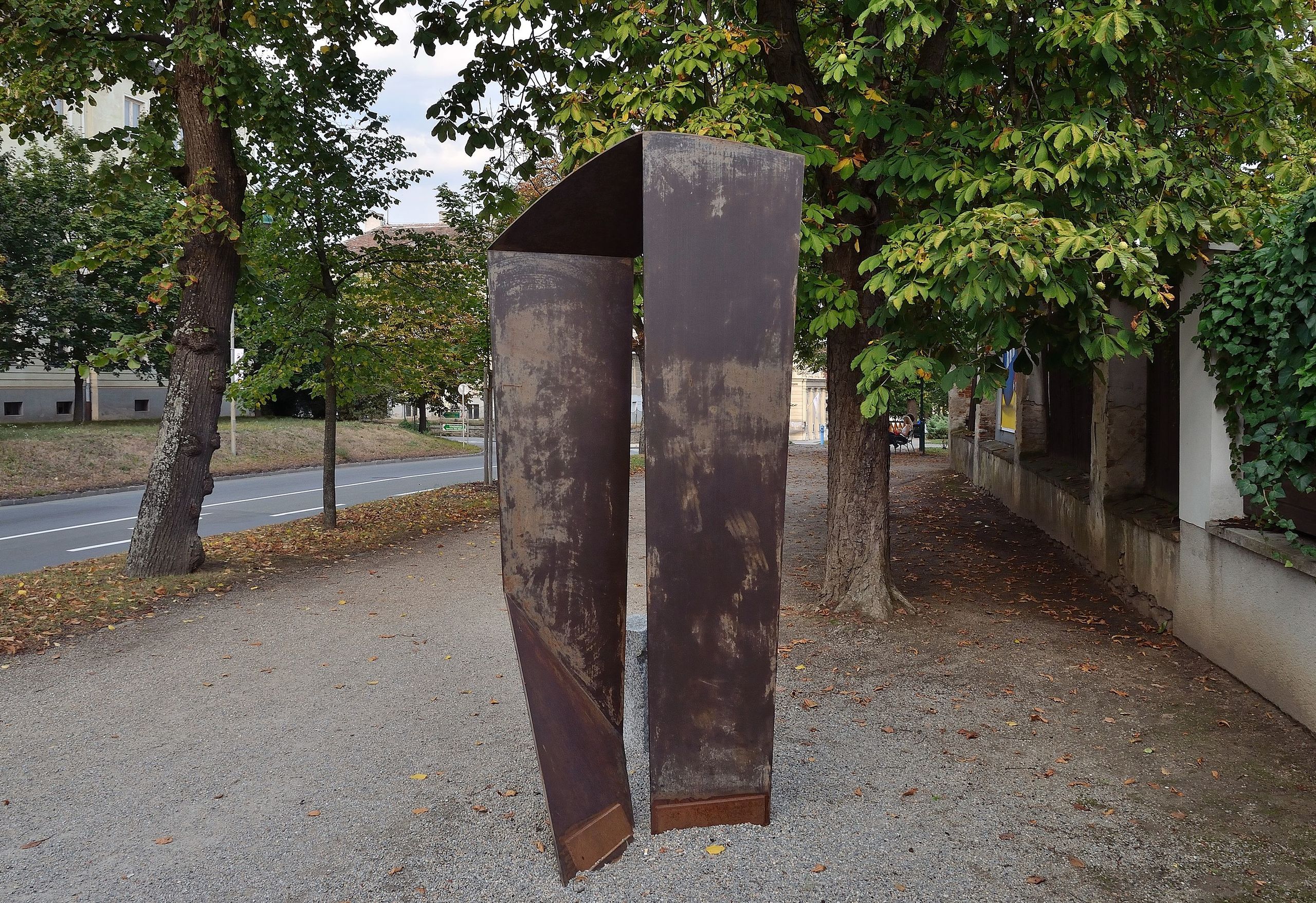
edit| Description |
Deutsch: Stahlskulptur in einer Allee in Horn: Faltung 18 von Marianne Maderna aus dem Jahre 1987. English: Steel sculpture in Horn, Lower Austria: Faltung 18 (Folding 18) by Marianne Maderna created in 1987.
|
|||
| Date | ||||
| Source | Own work | |||
| Author | Herzi Pinki |

| Camera location | | View this and other nearby images on: OpenStreetMap |
|---|
Licensing
edit
I, the copyright holder of this work, hereby publish it under the following license:
This file is licensed under the Creative Commons Attribution-Share Alike 3.0 Austria license.
- You are free:
- to share – to copy, distribute and transmit the work
- to remix – to adapt the work
- Under the following conditions:
- attribution – You must give appropriate credit, provide a link to the license, and indicate if changes were made. You may do so in any reasonable manner, but not in any way that suggests the licensor endorses you or your use.
- share alike – If you remix, transform, or build upon the material, you must distribute your contributions under the same or compatible license as the original.

File history
Click on a date/time to view the file as it appeared at that time.
| Date/Time | Thumbnail | Dimensions | User | Comment | |
|---|---|---|---|---|---|
| current | 23:33, 23 August 2015 | | 4,367 × 2,998 (6.71 MB) | Herzi Pinki (talk | contribs) | User created page with UploadWizard |
You cannot overwrite this file.
File usage on Commons
There are no pages that use this file.
File usage on other wikis
The following other wikis use this file:
- Usage on de.wikipedia.org