File:Flag-map of the Peru-Bolivian Confederation (states).svg

Size of this PNG preview of this SVG file: 508 × 600 pixels. Other resolutions: 203 × 240 pixels | 406 × 480 pixels | 650 × 768 pixels | 867 × 1,024 pixels | 1,734 × 2,048 pixels | 1,270 × 1,500 pixels.
Original file (SVG file, nominally 1,270 × 1,500 pixels, file size: 437 KB)
Captions
Captions
Add a one-line explanation of what this file represents
Summary edit
.svg&action=edit§ion=1)
| Description |
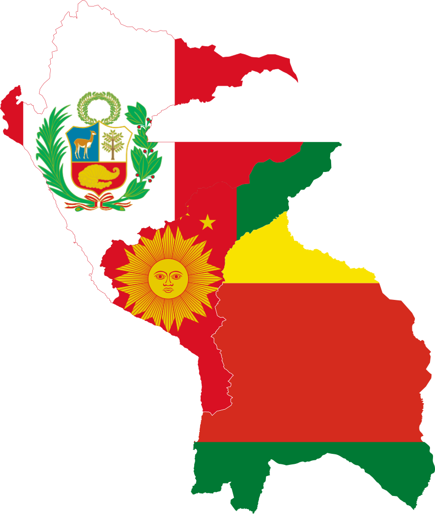
Español: Bandera-mapa de la Confederación Perú-Boliviana (con las banderas de los Estados).
English: Flag-map of the Peru-Bolivian Confederation (with state flags). |
| Date | |
| Source |
Own work File:Flag of South Peru.svg, File:Flag of Peru (1825-1950).svg & File:Flag of Bolivia (1826-1851).svg by Huhsunqu |
| Author |
Derivative work by: Janitoalevic Flags by: Huhsunqu |
.svg)
.svg)
Licensing edit
.svg&action=edit§ion=2)
I, the copyright holder of this work, hereby publish it under the following license:
This file is licensed under the Creative Commons Attribution-Share Alike 3.0 Unported license.
- You are free:
- to share – to copy, distribute and transmit the work
- to remix – to adapt the work
- Under the following conditions:
- attribution – You must give appropriate credit, provide a link to the license, and indicate if changes were made. You may do so in any reasonable manner, but not in any way that suggests the licensor endorses you or your use.
- share alike – If you remix, transform, or build upon the material, you must distribute your contributions under the same or compatible license as the original.
File history
Click on a date/time to view the file as it appeared at that time.
| Date/Time | Thumbnail | Dimensions | User | Comment | |
|---|---|---|---|---|---|
| current | 20:20, 22 July 2020 | | 1,270 × 1,500 (437 KB) | Janitoalevic (talk | contribs) | . |
| 20:16, 22 July 2020 |  | 1,270 × 1,500 (428 KB) | Janitoalevic (talk | contribs) | Uploaded own work with UploadWizard |
You cannot overwrite this file.
File usage on Commons
There are no pages that use this file.
.svg&oldid=794824001)