File:Flatz - Ortsansicht.JPG

Size of this preview: 800 × 450 pixels. Other resolutions: 320 × 180 pixels | 640 × 360 pixels | 1,024 × 576 pixels | 1,280 × 720 pixels | 2,560 × 1,440 pixels | 5,200 × 2,925 pixels.
Original file (5,200 × 2,925 pixels, file size: 10.26 MB, MIME type: image/jpeg)
Captions
Captions
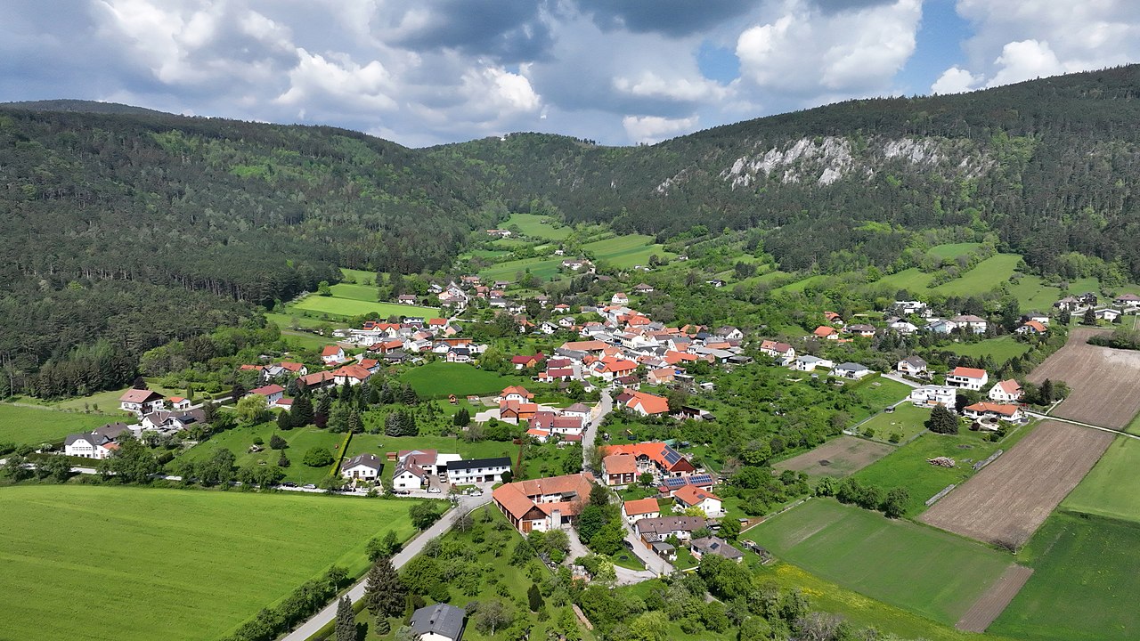
Southeast view of Flatz, Lower Austria.
Summary edit
| Description |
Deutsch: Südostansicht von Flatz, eine Ortschaft in der niederösterreichischen Stadtgemeinde Ternitz und rechts die Flatzer Wand, eine Felswand des 790 m hohen Berges Auf der Kehr. Weiters in der Bildmitte ganz im Hintergrund das Neunkirchner Naturfreundehaus, auch als Naturfreundehaus Flatzer Wand bezeichnet.
Bis zur Eingemeindung nach Ternitz mit 1. Jän. 1969 bildete der Ort eine eigene Ortsgemeinde, der auch St. Lorenzen und Reith angehörten. English: Southeast view of Flatz, Lower Austria. |
| Date | |
| Source | Own work |
| Author | C.Stadler/Bwag |
| Permission (Reusing this file) |
Deutsch: Hallo, du darfst mein Foto kostenlos nutzen, aber nenne mich bitte als Fotograf, beispielsweise „Foto: C.Stadler/Bwag“ oder © C.Stadler/Bwag; CC-BY-SA-4.0. Auf mehr Angaben bestehe ich nicht - im Gegensatz zu manch anderen, die die Vorgaben der unten angeführten Lizenzierung auf Punkt und Beistrich einfordern. English: Feel free to use my photos, but please mention me as the author like © C.Stadler/Bwag or © C.Stadler/Bwag; CC-BY-SA-4.0 (that's good enough) and if you want send me a message: bwag@gmx.net. |
| Object location | | View this and other nearby images on: OpenStreetMap |
|---|
| Camera location | | View this and other nearby images on: OpenStreetMap |
|---|
Licensing edit
I, the copyright holder of this work, hereby publish it under the following license:
This file is licensed under the Creative Commons Attribution-Share Alike 4.0 International license.
- You are free:
- to share – to copy, distribute and transmit the work
- to remix – to adapt the work
- Under the following conditions:
- attribution – You must give appropriate credit, provide a link to the license, and indicate if changes were made. You may do so in any reasonable manner, but not in any way that suggests the licensor endorses you or your use.
- share alike – If you remix, transform, or build upon the material, you must distribute your contributions under the same or compatible license as the original.
| Annotations | This image is annotated: View the annotations at Commons |
_-_Neunkirchner_Naturfreundehaus_(a).JPG)
File history
Click on a date/time to view the file as it appeared at that time.
| Date/Time | Thumbnail | Dimensions | User | Comment | |
|---|---|---|---|---|---|
| current | 06:50, 11 May 2022 | | 5,200 × 2,925 (10.26 MB) | Bwag (talk | contribs) | == {{int:filedesc}} == {{Information |Description= {{de|1= Südostansicht von Flatz, eine Ortschaft in der niederösterreichischen Stadtgemeinde Ternitz und rechts die Flatzer Wand, ein Felsabbruch des 790 m hohen Berges ''Auf der Kehr''. Weiters in der Bildmitte ganz im Hintergrund das Neunkirchner Naturfreundehaus, auch als ''Naturfreundehaus Flatzer Wand'' bezeichnet.}} {{en|1= Southeast view of Flatz, Lower Austria.}} |Source= {{own}} |Date= 2022-05-10 |Author= Bwag |Permiss... |
You cannot overwrite this file.
File usage on Commons
There are no pages that use this file.
File usage on other wikis
The following other wikis use this file:
- Usage on de.wikipedia.org