File:Franzosentrift.jpg

Size of this preview: 800 × 568 pixels. Other resolutions: 320 × 227 pixels | 640 × 454 pixels | 1,024 × 727 pixels | 1,280 × 909 pixels | 2,560 × 1,818 pixels | 3,166 × 2,248 pixels.
Original file (3,166 × 2,248 pixels, file size: 2.57 MB, MIME type: image/jpeg)
Captions
Captions
Add a one-line explanation of what this file represents
Summary
edit
| Description |
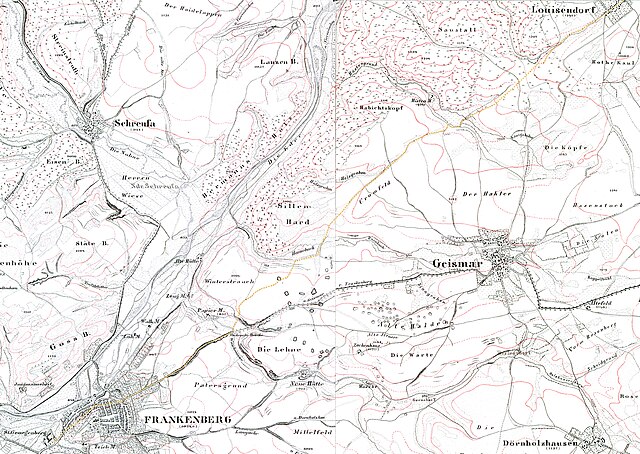
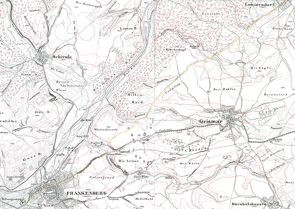
Ein möglicher Verlauf der Franzosentrift von Louisendorf zum Kloster St. Georgen. Ich habe mich wo möglich an eingezeichneten Wegen und heute noch bekannten Flurnamen orientiert. Von lousendorf bis zum Heinebach ist der Verlauf klar, da der Weg heute noch so heißt. Ausschnitte aus Kartenblatt Frankenberg und Kartenblatt Frankenau, Landesaufnahme von 1857 Aus: Kurfürstenthum Hessen : Niveau Karte auf 112 Blättern 112 Blätter · 1 : 25000 · Kassel 1840-1861 |
| Date | |
| Source | Own work; source maps: Kartenblatt Frankenberg Kartenblatt Frankenau |
| Author | Kersti Nebelsiek |
Licensing
edit
I, the copyright holder of this work, hereby publish it under the following licenses:

|
Permission is granted to copy, distribute and/or modify this document under the terms of the GNU Free Documentation License, Version 1.2 or any later version published by the Free Software Foundation; with no Invariant Sections, no Front-Cover Texts, and no Back-Cover Texts. A copy of the license is included in the section entitled GNU Free Documentation License. |
This file is licensed under the Creative Commons Attribution-Share Alike Attribution-Share Alike 4.0 International, 3.0 Unported, 2.5 Generic, 2.0 Generic and 1.0 Generic license.
- You are free:
- to share – to copy, distribute and transmit the work
- to remix – to adapt the work
- Under the following conditions:
- attribution – You must give appropriate credit, provide a link to the license, and indicate if changes were made. You may do so in any reasonable manner, but not in any way that suggests the licensor endorses you or your use.
- share alike – If you remix, transform, or build upon the material, you must distribute your contributions under the same or compatible license as the original.
You may select the license of your choice.
]
File history
Click on a date/time to view the file as it appeared at that time.
| Date/Time | Thumbnail | Dimensions | User | Comment | |
|---|---|---|---|---|---|
| current | 21:36, 2 May 2024 | | 3,166 × 2,248 (2.57 MB) | Kersti Nebelsiek (talk | contribs) | == {{int:filedesc}} == {{Information |Description= Franzosentrift von Louisendorf Ausschnitte aus Kartenblatt Frankenberg und Kartenblatt Frankenau, Landesaufnahme von 1857 Aus: Kurfürstenthum Hessen : Niveau Karte auf 112 Blättern 112 Blätter · 1 : 25000 · Kassel 1840-1861 |Date=2024-05-02 |Source={{own}}; source maps: [https://www.lagis-hessen.de/de/subjects/browse/id/2/current/38/sn/hkw Kartenblatt Frankenberg] [https://www.lagis-hessen.de/de/subjects/browse/id/2/current/39/sn/hkw Karte... |
You cannot overwrite this file.
File usage on Commons
There are no pages that use this file.