File:Friûl map.png

Size of this preview: 657 × 600 pixels. Other resolutions: 263 × 240 pixels | 526 × 480 pixels | 1,018 × 929 pixels.
Original file (1,018 × 929 pixels, file size: 141 KB, MIME type: image/png)
Captions
Captions
Add a one-line explanation of what this file represents
Summary edit
| Description |
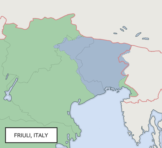
Furlan: Imagjine dal Friûl inte Europe |
| Date | |
| Source | Own work |
| Author | Gianmarco139 |
Licensing edit
I, the copyright holder of this work, hereby publish it under the following license:
This file is licensed under the Creative Commons Attribution 4.0 International license.
- You are free:
- to share – to copy, distribute and transmit the work
- to remix – to adapt the work
- Under the following conditions:
- attribution – You must give appropriate credit, provide a link to the license, and indicate if changes were made. You may do so in any reasonable manner, but not in any way that suggests the licensor endorses you or your use.
File history
Click on a date/time to view the file as it appeared at that time.
| Date/Time | Thumbnail | Dimensions | User | Comment | |
|---|---|---|---|---|---|
| current | 20:08, 28 November 2020 | | 1,018 × 929 (141 KB) | GalaxMaps (talk | contribs) | fixed small mistakes |
| 19:14, 28 November 2020 |  | 1,018 × 929 (139 KB) | GalaxMaps (talk | contribs) | redid the entire map, made a to a cleaner version with more clear borders | |
| 23:19, 29 January 2019 |  | 1,083 × 745 (1.54 MB) | Gianmarco139 (talk | contribs) | Reverted to version as of 18:00, 29 January 2019 (UTC) | |
| 23:19, 29 January 2019 |  | 1,083 × 745 (1.54 MB) | Gianmarco139 (talk | contribs) | Reverted to version as of 11:27, 29 January 2019 (UTC) | |
| 18:00, 29 January 2019 |  | 1,083 × 745 (1.54 MB) | Gianmarco139 (talk | contribs) | Preciser borders at Gorizia/Goriza | |
| 11:27, 29 January 2019 |  | 1,083 × 745 (1.54 MB) | Gianmarco139 (talk | contribs) | More detailed map. The borders follow the river Livenza, the territory of Cadore, the ancient border of Pontebba/Pontafel, and the rivers Isonzo/Soča and Timavo/Timav. | |
| 10:55, 28 May 2015 |  | 544 × 370 (48 KB) | Gianmarco139 (talk | contribs) | Revision | |
| 10:38, 28 May 2015 |  | 544 × 370 (48 KB) | Gianmarco139 (talk | contribs) | Revision | |
| 11:41, 27 May 2015 |  | 544 × 370 (48 KB) | Gianmarco139 (talk | contribs) | Adapted dimensions | |
| 11:37, 27 May 2015 |  | 600 × 370 (36 KB) | Gianmarco139 (talk | contribs) | More detailed map (zoomed) |
You cannot overwrite this file.
File usage on Commons
The following page uses this file:
File usage on other wikis
The following other wikis use this file:
- Usage on af.wikipedia.org
- Usage on ar.wikipedia.org
- Usage on bg.wikipedia.org
- Usage on ca.wikipedia.org
- Usage on da.wikipedia.org
- Usage on de.wikipedia.org
- Usage on eo.wikipedia.org
- Usage on es.wikipedia.org
- Usage on et.wikipedia.org
- Usage on fa.wikipedia.org
- Usage on fr.wikipedia.org
- Usage on hu.wikipedia.org
- Usage on io.wikipedia.org
- Usage on it.wikivoyage.org
- Usage on ja.wikipedia.org
- Usage on la.wikipedia.org
- Usage on lt.wikipedia.org
- Usage on nl.wikipedia.org
- Usage on oc.wikipedia.org
- Usage on os.wikipedia.org
- Usage on pl.wikipedia.org
- Usage on pt.wikipedia.org
- Usage on ru.wikipedia.org
- Usage on sv.wikipedia.org
- Usage on tl.wikipedia.org
- Usage on uk.wikipedia.org
- Usage on vec.wikipedia.org
- Usage on www.wikidata.org
- Usage on zh.wikipedia.org