File:G.P. Rouffaer - Kaart van het eiland Adonara - Map of the island Adonara, Indonesia - 1910.jpg

Size of this preview: 800 × 586 pixels. Other resolutions: 320 × 234 pixels | 640 × 469 pixels | 1,024 × 750 pixels | 1,337 × 979 pixels.
Original file (1,337 × 979 pixels, file size: 421 KB, MIME type: image/jpeg)
Captions
Captions
Add a one-line explanation of what this file represents
Summary
edit
| Description |
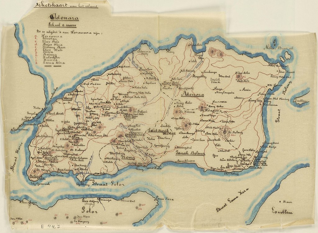
Nederlands: Kaart van Adonara, Kleine Soenda eilanden, Indonesië door G.P. Rouffaer, 1910. Rijksuniversiteit Leiden. Schaal 1:100.000. Universiteit Leiden. RU Leiden - D_E_44_5.
English: Map of Adonara, Lesser Sunda Islands, Indonesia by G.P. Rouffaer in 1910. Scale 1:100.000. Leiden University. RU Leiden - D_E_44_5. |
| Date | |
| Source | ikat.us. Retrieved on 24 June 2020. |
| Author | Rouffaer, Gerret Pieter (1860-1928) |
Licensing
edit
|
This work is in the public domain in its country of origin and other countries and areas where the copyright term is the author's life plus 70 years or fewer. This work is in the public domain in the United States because it was published (or registered with the U.S. Copyright Office) before January 1, 1929. | |
| This file has been identified as being free of known restrictions under copyright law, including all related and neighboring rights. | |
File history
Click on a date/time to view the file as it appeared at that time.
| Date/Time | Thumbnail | Dimensions | User | Comment | |
|---|---|---|---|---|---|
| current | 07:27, 24 June 2020 | | 1,337 × 979 (421 KB) | Hansmuller (talk | contribs) | Uploaded a work by Rouffaer, Gerret Pieter (1860-1928) from [https://ikat.us/ikat_solor%20archipelago_adonara.php ikat.us]. Retrieved on 24 June 2020. with UploadWizard |
You cannot overwrite this file.
File usage on Commons
There are no pages that use this file.
File usage on other wikis
The following other wikis use this file:
- Usage on nl.wikipedia.org