File:Gauting map.png

Size of this preview: 709 × 599 pixels. Other resolutions: 284 × 240 pixels | 568 × 480 pixels | 908 × 768 pixels | 1,211 × 1,024 pixels | 1,787 × 1,511 pixels.
Original file (1,787 × 1,511 pixels, file size: 1.82 MB, MIME type: image/png)
Captions
Captions
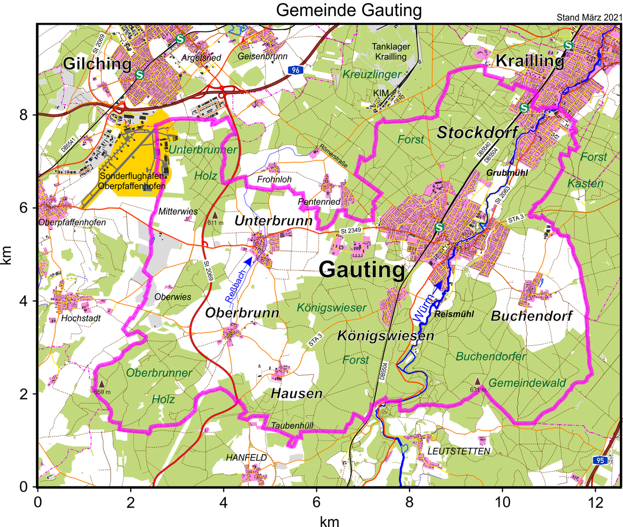
Municipal boundary and suburbs of Gauting
Summary
edit
| Description |
Deutsch: Die Karte zeigt die Gemeindegrenze und die Lage der Ortsteile von Gauting. Stand März 2021.
English: The map shows the municipal boundary and the location of suburbs of Gauting. Last update March 2021. |
| Date | |
| Source | Own work |
| Author | Periphrastika |
Map data: © OpenStreetMap and contributors
Licensing
edit
I, the copyright holder of this work, hereby publish it under the following license:
This file is licensed under the Creative Commons Attribution-Share Alike 4.0 International license.
- You are free:
- to share – to copy, distribute and transmit the work
- to remix – to adapt the work
- Under the following conditions:
- attribution – You must give appropriate credit, provide a link to the license, and indicate if changes were made. You may do so in any reasonable manner, but not in any way that suggests the licensor endorses you or your use.
- share alike – If you remix, transform, or build upon the material, you must distribute your contributions under the same or compatible license as the original.
File history
Click on a date/time to view the file as it appeared at that time.
| Date/Time | Thumbnail | Dimensions | User | Comment | |
|---|---|---|---|---|---|
| current | 14:54, 2 April 2021 | | 1,787 × 1,511 (1.82 MB) | Periphrastika (talk | contribs) | update |
| 08:38, 24 March 2021 |  | 1,260 × 1,069 (1.23 MB) | Periphrastika (talk | contribs) | Uploaded own work with UploadWizard |
You cannot overwrite this file.
File usage on Commons
There are no pages that use this file.