File:Geodetic Survey in the U.S. Virgin Islands.jpg

Size of this preview: 800 × 533 pixels. Other resolutions: 320 × 213 pixels | 640 × 427 pixels | 1,024 × 683 pixels | 1,290 × 860 pixels.
Original file (1,290 × 860 pixels, file size: 256 KB, MIME type: image/jpeg)
Captions
Captions
Add a one-line explanation of what this file represents
| Description |
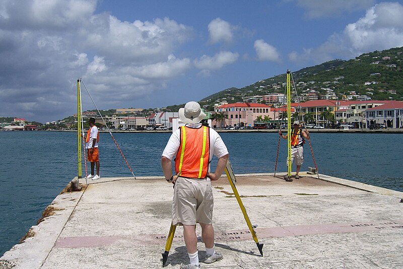
English: NOAA's National Geodetic Survey employees level to a pier as part of a larger island-wide project to provide St. Thomas, U.S. Virgin Islands with a vertical datum. (Original source: National Ocean Service Image Gallery)
Français : Nivellement d'un quai, à l'aide d'un niveau à code-barres Leica DNA3, et de 2 mires de 3 mètres en Invar. |
||
| Date | |||
| Source | originally posted to Flickr as Geodetic Survey in the U.S. Virgin Islands | ||
| Author | NOAA's National Ocean Service | ||
| Permission (Reusing this file) |
This file is licensed under the Creative Commons Attribution 2.0 Generic license.
|
File history
Click on a date/time to view the file as it appeared at that time.
| Date/Time | Thumbnail | Dimensions | User | Comment | |
|---|---|---|---|---|---|
| current | 00:42, 18 October 2017 | | 1,290 × 860 (256 KB) | VortBot (talk | contribs) | Uploading higher resolution from Flickr |
| 13:52, 20 December 2009 |  | 1,024 × 683 (433 KB) | Flickr upload bot (talk | contribs) | Uploaded from http://flickr.com/photo/40322276@N04/3749301237 using Flickr upload bot |
You cannot overwrite this file.
File usage on Commons
There are no pages that use this file.
File usage on other wikis
The following other wikis use this file: