File:GifuKenMap2006-03.png
GifuKenMap2006-03.png (250 × 260 pixels, file size: 8 KB, MIME type: image/png)
Captions
Captions
Summary
edit
| Description |
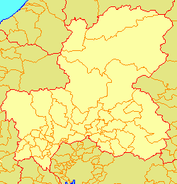
日本語: 岐阜県市町村境界図 (2006年3月-)
岐阜県の市町村の地図一覧
|
||||||||||||||||||||||||||||||||||||||||||||||||||||||||||||||||||||||||||||||||||||||||||||||||||||||||||||||||||||||||||||||||||||||||||||||||||||||||||||||||||||||||
| Source | File:Japan map.png | ||||||||||||||||||||||||||||||||||||||||||||||||||||||||||||||||||||||||||||||||||||||||||||||||||||||||||||||||||||||||||||||||||||||||||||||||||||||||||||||||||||||||
| Author |
|
||||||||||||||||||||||||||||||||||||||||||||||||||||||||||||||||||||||||||||||||||||||||||||||||||||||||||||||||||||||||||||||||||||||||||||||||||||||||||||||||||||||||
| Permission (Reusing this file) |
|
||||||||||||||||||||||||||||||||||||||||||||||||||||||||||||||||||||||||||||||||||||||||||||||||||||||||||||||||||||||||||||||||||||||||||||||||||||||||||||||||||||||||
Licensing
edit

|
Permission is granted to copy, distribute and/or modify this document under the terms of the GNU Free Documentation License, Version 1.2 or any later version published by the Free Software Foundation; with no Invariant Sections, no Front-Cover Texts, and no Back-Cover Texts. A copy of the license is included in the section entitled GNU Free Documentation License. |
- You are free:
- to share – to copy, distribute and transmit the work
- to remix – to adapt the work
- Under the following conditions:
- attribution – You must give appropriate credit, provide a link to the license, and indicate if changes were made. You may do so in any reasonable manner, but not in any way that suggests the licensor endorses you or your use.
- share alike – If you remix, transform, or build upon the material, you must distribute your contributions under the same or compatible license as the original.
File history
Click on a date/time to view the file as it appeared at that time.
| Date/Time | Thumbnail | Dimensions | User | Comment | |
|---|---|---|---|---|---|
| current | 00:13, 7 September 2006 | | 250 × 260 (8 KB) | Knua (talk | contribs) | 県外の境界変更を反映 |
| 16:04, 17 August 2006 |  | 250 × 260 (8 KB) | Knua (talk | contribs) | 八百津町と御嵩町の町境の加筆 | |
| 16:01, 17 August 2006 |  | 250 × 260 (8 KB) | Knua (talk | contribs) | 八百津町と御岳町の町境の加筆 | |
| 11:38, 17 August 2006 |  | 250 × 260 (8 KB) | Knua (talk | contribs) | 岐阜県市町村境界図 (2006年3月-) |
You cannot overwrite this file.
File usage on Commons
There are no pages that use this file.