File:Great Central Main Line map.png
Size of this preview: 527 × 600 pixels. Other resolutions: 211 × 240 pixels | 422 × 480 pixels | 891 × 1,014 pixels.
Original file (891 × 1,014 pixels, file size: 78 KB, MIME type: image/png)
Captions
Captions
Add a one-line explanation of what this file represents
Summary
edit
| Description |
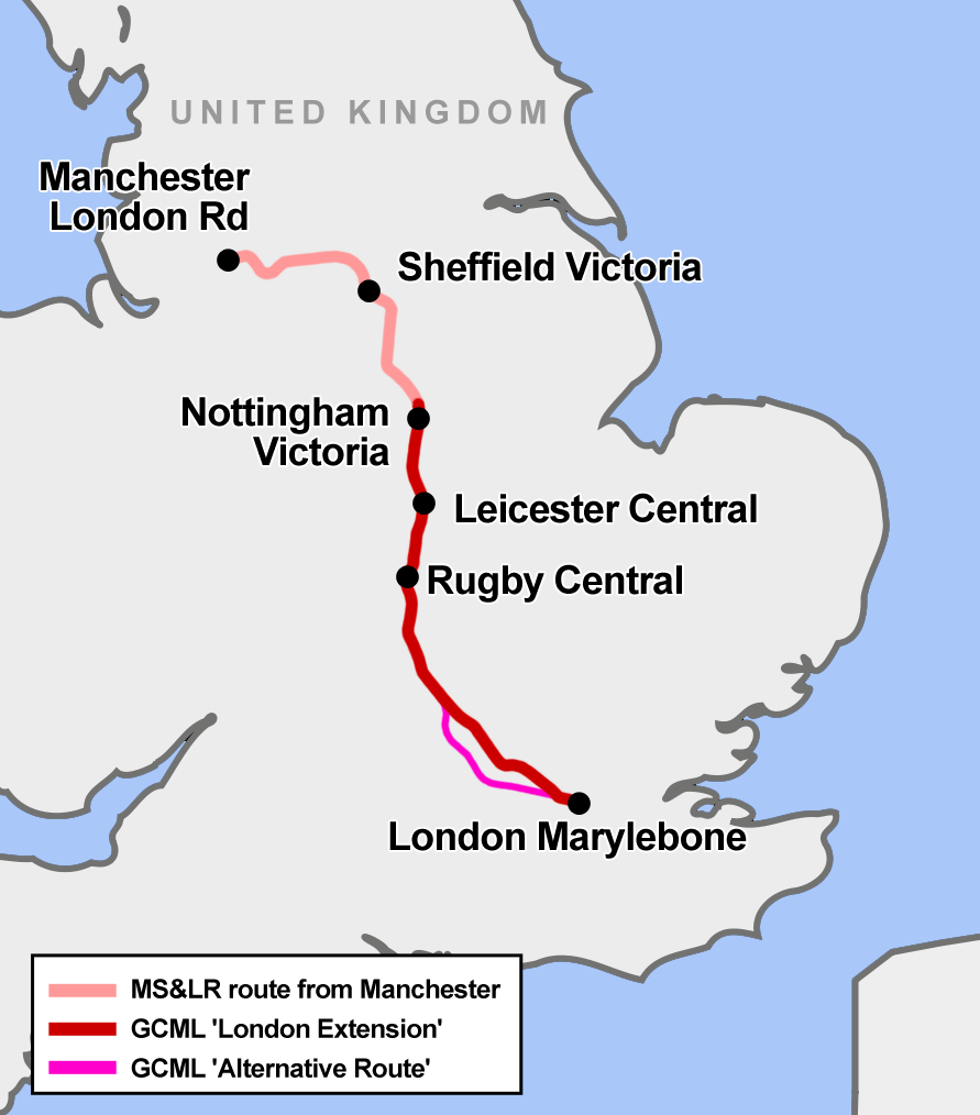
English: Map of England showing the route of the former Great Central Main Line, a fast railway line which opened in 1899 between Sheffield and London. It was designed by the railway baron Edward Watkin. His 1880s Channel tunnel project failed but his railway ran express trains to London until 1966, when it was closed during the Beeching cuts. A short section of the route is to be re-built for the planned HS2 line. |
| Date | |
| Source | Own work |
| Author | Cnbrb |
Licensing
edit
I, the copyright holder of this work, hereby publish it under the following license:
| This file is made available under the Creative Commons CC0 1.0 Universal Public Domain Dedication. | |
| The person who associated a work with this deed has dedicated the work to the public domain by waiving all of their rights to the work worldwide under copyright law, including all related and neighboring rights, to the extent allowed by law. You can copy, modify, distribute and perform the work, even for commercial purposes, all without asking permission.
|
File history
Click on a date/time to view the file as it appeared at that time.
| Date/Time | Thumbnail | Dimensions | User | Comment | |
|---|---|---|---|---|---|
| current | 21:44, 4 July 2015 | | 891 × 1,014 (78 KB) | Cmdrjameson (talk | contribs) | Compressed with pngout. Reduced by 48kB (38% decrease). |
| 11:14, 9 September 2013 |  | 891 × 1,014 (127 KB) | Cnbrb (talk | contribs) | add the 1906 "alternative route" | |
| 10:38, 9 September 2013 |  | 891 × 1,014 (120 KB) | Cnbrb (talk | contribs) | User created page with UploadWizard |
You cannot overwrite this file.
File usage on Commons
The following 5 pages use this file:
File usage on other wikis
The following other wikis use this file:
- Usage on de.wikipedia.org
- Usage on en.wikipedia.org
- Usage on fr.wikipedia.org
- Usage on www.wikidata.org