File:Guilmin map of Paris, France, Monuments - Geographicus - Paris-Guilmin.jpg

Size of this preview: 800 × 589 pixels. Other resolutions: 320 × 236 pixels | 640 × 471 pixels | 1,024 × 754 pixels | 1,280 × 942 pixels | 2,560 × 1,884 pixels | 5,000 × 3,680 pixels.
Original file (5,000 × 3,680 pixels, file size: 5.84 MB, MIME type: image/jpeg)
Captions
Captions
Add a one-line explanation of what this file represents
Summary
edit
| Nouveau Plan de Paris Monumental. | |||
|---|---|---|---|
| Artist |
L. Guilmin |
||
| Title |
Nouveau Plan de Paris Monumental. |
||
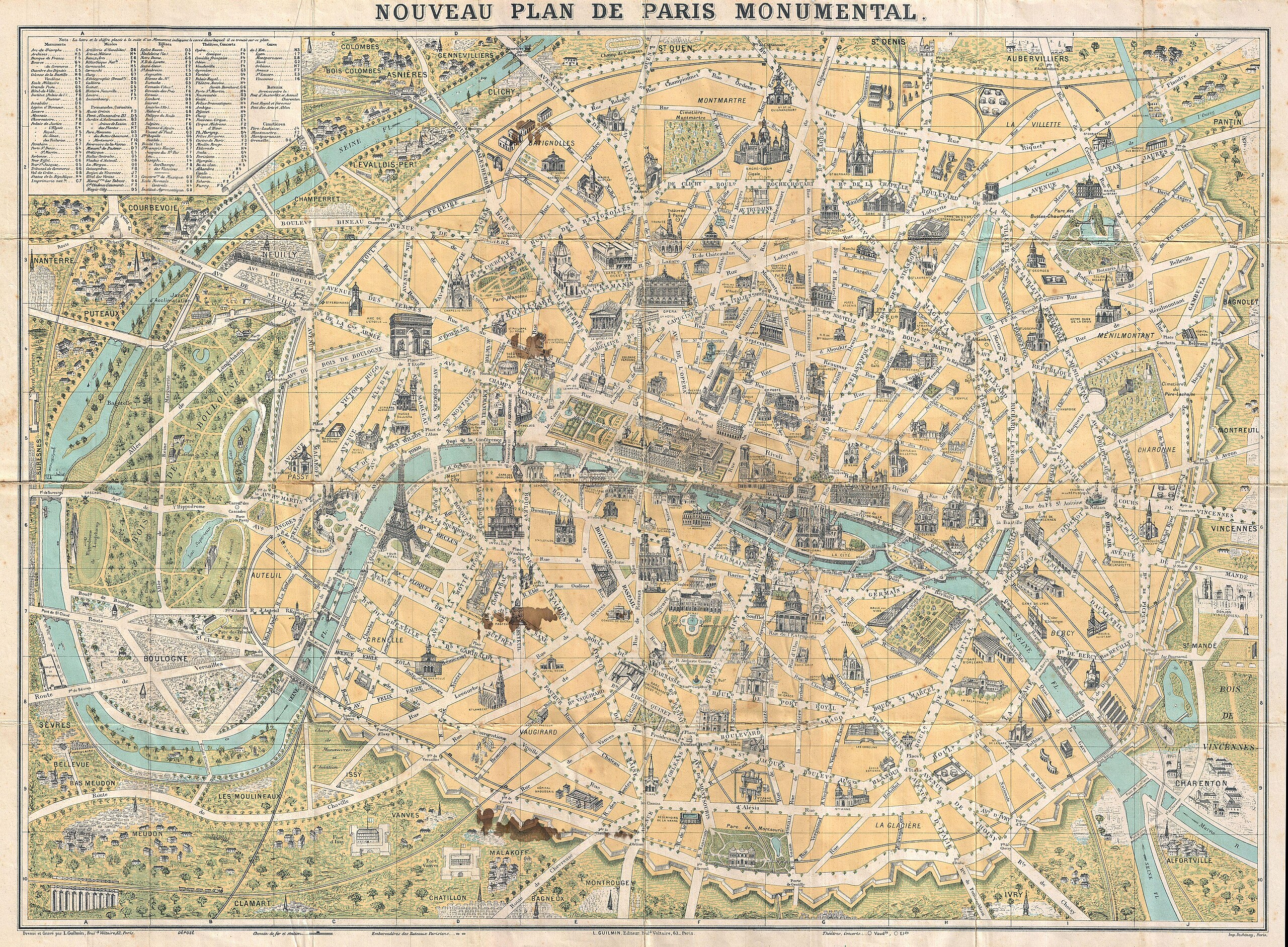
| Description |
English: An attractive map of Paris, France by L. Guilmin. Covers the old walled city of Paris and the immediate vicinity, especially to the west. Important buildings are shown in profile. All major streets are identified. Identifies numerous buildings and a number of surrounding communities and gardens, including the Bois de Boulogne. |
||
| Date | Unknown date | ||
| Dimensions | height: 21 in (53.3 cm); width: 28.5 in (72.3 cm) | ||
| Accession number |
Geographicus link: Paris-guilmin-1890 |
||
| Source/Photographer |
|
||
Licensing
edit
|
This work is in the public domain in its country of origin and other countries and areas where the copyright term is the author's life plus 100 years or fewer. | |
| This file has been identified as being free of known restrictions under copyright law, including all related and neighboring rights. | |
File history
Click on a date/time to view the file as it appeared at that time.
| Date/Time | Thumbnail | Dimensions | User | Comment | |
|---|---|---|---|---|---|
| current | 01:03, 24 March 2011 | | 5,000 × 3,680 (5.84 MB) | BotMultichillT (talk | contribs) | {{subst:User:Multichill/Geographicus |link=http://www.geographicus.com/P/AntiqueMap/Paris-guilmin-1890 |product_name=1890 Guilmin Map of Paris, France w/Monuments |map_title=Nouveau Plan de Paris Monumental. |description=An attractive map of Paris, France |
You cannot overwrite this file.
File usage on Commons
The following 3 pages use this file:
File usage on other wikis
The following other wikis use this file:
- Usage on de.wikipedia.org
- Usage on fr.wikipedia.org