File:Hütteldorf (Wien) - Trinitatiskirche (b).JPG
Size of this preview: 800 × 450 pixels. Other resolutions: 320 × 180 pixels | 640 × 360 pixels | 1,024 × 576 pixels | 1,280 × 720 pixels | 2,560 × 1,440 pixels | 5,760 × 3,240 pixels.
Original file (5,760 × 3,240 pixels, file size: 9.03 MB, MIME type: image/jpeg)
Captions
Captions
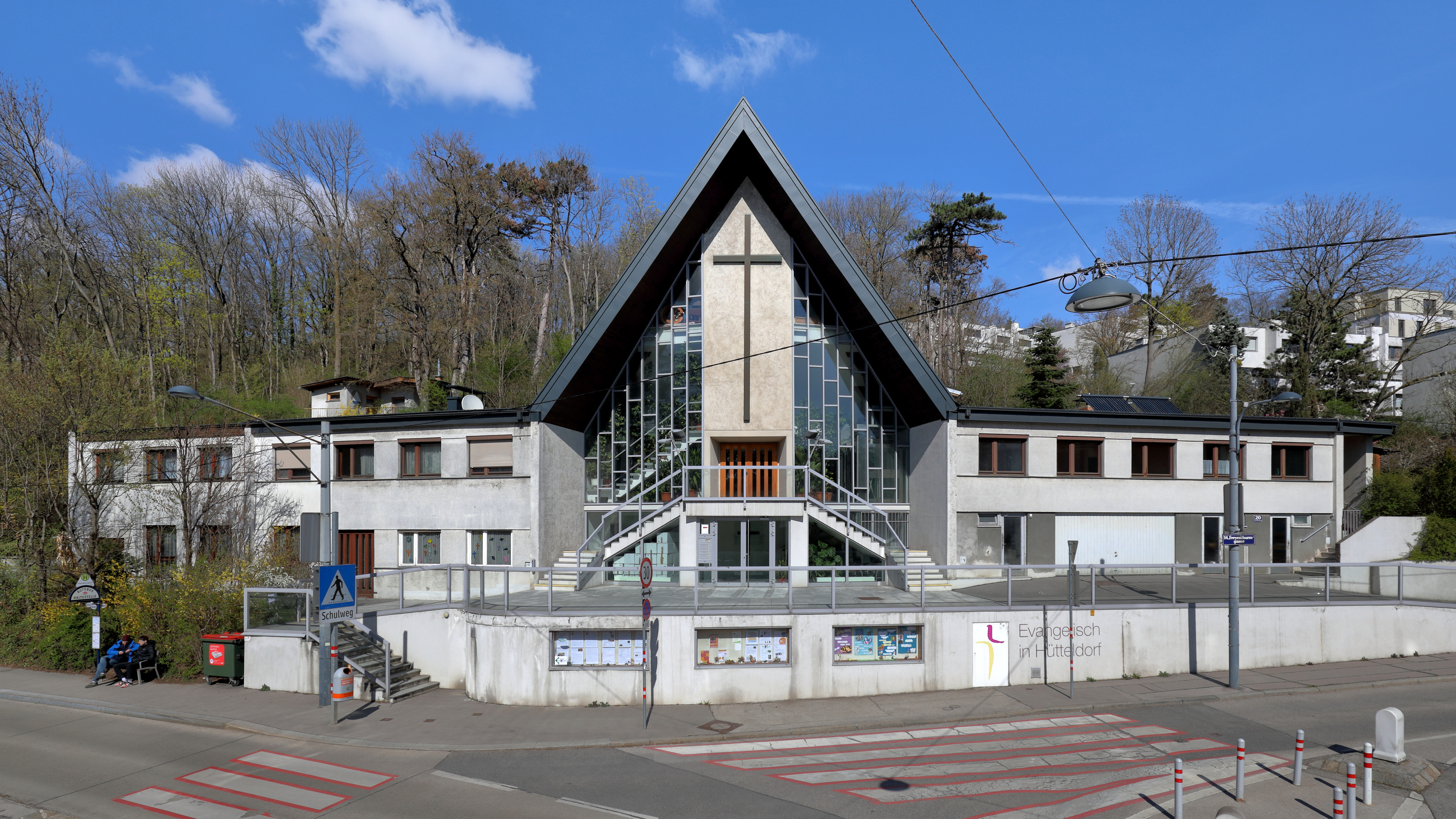
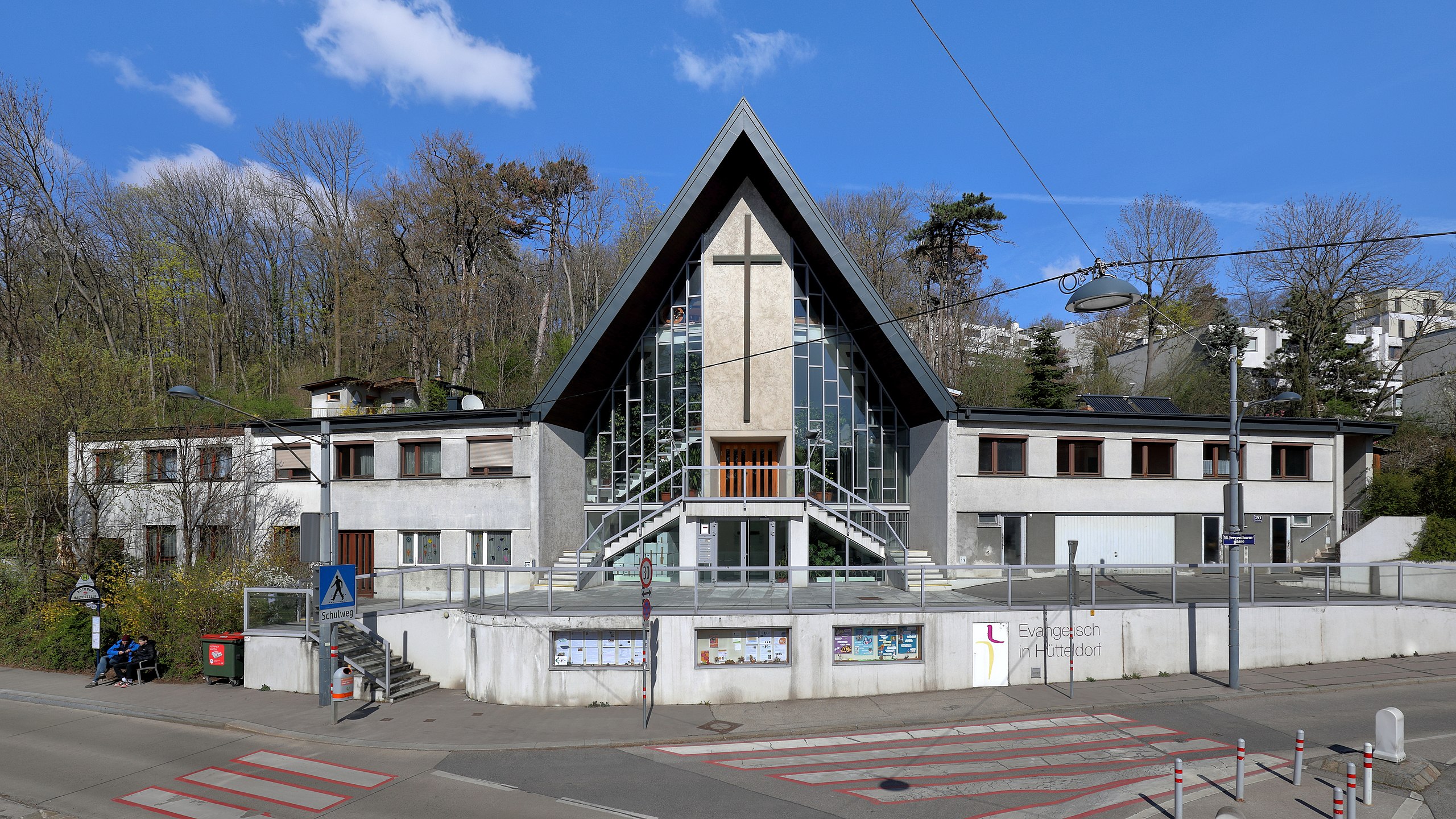
The Evangelical Lutheran Church of the Holy Trinity in Vienna.
Summary
edit| Description |
Deutsch: Die Trinitatiskirche und Anbauten der evangelischen Pfarrgemeinde A.B. Wien-Hütteldorf an der Adresse Freyenthurmgasse 20 im 14. Wiener Gemeindebezirk Penzing.
Die Kirche wurde ab 1967 nach Plänen des Architekten Sepp Schuster errichtet und zum Trinitatisfest 1968 feierlich eröffnet. Unter Pfarrer Hartmut Schlener wurde 1992 ein Zubau und 1994 ein weiterer zweistöckiger Erweiterungsbau eröffnet. Ab 2009 wurde der Vorbau der Kirche neu gestaltet und ein Jugend-Kirche-Haus auf dem Pfarrgelände errichtet. Am 7. Mai 2011 fand dann unter Superintendent Hansjörg Lein die offizielle Eröffnung statt: [1]. English: The Evangelical Lutheran Church of the Holy Trinity in Vienna. |
| Date | |
| Source | Own work |
| Author | C.Stadler/Bwag |
| Permission (Reusing this file) |
Deutsch: Hallo, du darfst mein Foto kostenlos nutzen, aber nenne mich bitte als Fotograf, beispielsweise „Foto: C.Stadler/Bwag“ oder © C.Stadler/Bwag; CC-BY-SA-4.0. Auf mehr Angaben bestehe ich nicht - im Gegensatz zu manch anderen, die die Vorgaben der unten angeführten Lizenzierung auf Punkt und Beistrich einfordern. English: Feel free to use my photos, but please mention me as the author like © C.Stadler/Bwag or © C.Stadler/Bwag; CC-BY-SA-4.0 (that's good enough) and if you want send me a message: bwag@gmx.net. |
| Other versions |
|
_-_Trinitatiskirche_(a).JPG)
_-_Trinitatiskirche_(b).JPG&action=edit§ion=1)
| Object location | | View this and other nearby images on: OpenStreetMap |
|---|
_-_Trinitatiskirche_(b).JPG¶ms=048.205460_N_0016.257090_E_globe:Earth_class:object_type:object__&language=en)
| Camera location | | View this and other nearby images on: OpenStreetMap |
|---|
_-_Trinitatiskirche_(b).JPG¶ms=048.205270_N_0016.256800_E_globe:Earth_type:camera_heading:45.00&language=en)
Licensing
edit_-_Trinitatiskirche_(b).JPG&action=edit§ion=2)
I, the copyright holder of this work, hereby publish it under the following license:
This file is licensed under the Creative Commons Attribution-Share Alike 4.0 International license.
- You are free:
- to share – to copy, distribute and transmit the work
- to remix – to adapt the work
- Under the following conditions:
- attribution – You must give appropriate credit, provide a link to the license, and indicate if changes were made. You may do so in any reasonable manner, but not in any way that suggests the licensor endorses you or your use.
- share alike – If you remix, transform, or build upon the material, you must distribute your contributions under the same or compatible license as the original.
File history
Click on a date/time to view the file as it appeared at that time.
| Date/Time | Thumbnail | Dimensions | User | Comment | |
|---|---|---|---|---|---|
| current | 20:13, 7 April 2023 | | 5,760 × 3,240 (9.03 MB) | Bwag (talk | contribs) | == {{int:filedesc}} == {{Information |Description= {{de|1=Die Trinitatiskirche und Anbauten der evangelischen Pfarrgemeinde A.B. Wien-Hütteldorf an der Adresse ''Freyenthurmgasse 20'' im 14. Wiener Gemeindebezirk Penzing.<br/>Die Kirche wurde ab 1967 nach Plänen des Architekten Sepp Schuster errichtet und zum Trinitatisfest 1968 feierlich eröffnet. Unter Pfarrer Hartmut Schlener wurde 1992 ein Zubau und 1994 ein weiterer zweistöckiger Erweiterungsbau eröffnet. Ab 2009 wurde der Vorbau der Ki... |
You cannot overwrite this file.
File usage on Commons
The following page uses this file:
File usage on other wikis
The following other wikis use this file:
- Usage on de.wikipedia.org
- Usage on fa.wikipedia.org
_-_Trinitatiskirche_(b).JPG&oldid=825104634)