File:Hradec Králové, schéma aut. st. Koruna.jpg
Size of this preview: 800 × 600 pixels. Other resolutions: 320 × 240 pixels | 640 × 480 pixels | 1,024 × 768 pixels | 1,280 × 960 pixels | 2,048 × 1,536 pixels.
Original file (2,048 × 1,536 pixels, file size: 585 KB, MIME type: image/jpeg)
Captions
Captions
Add a one-line explanation of what this file represents
| Description |
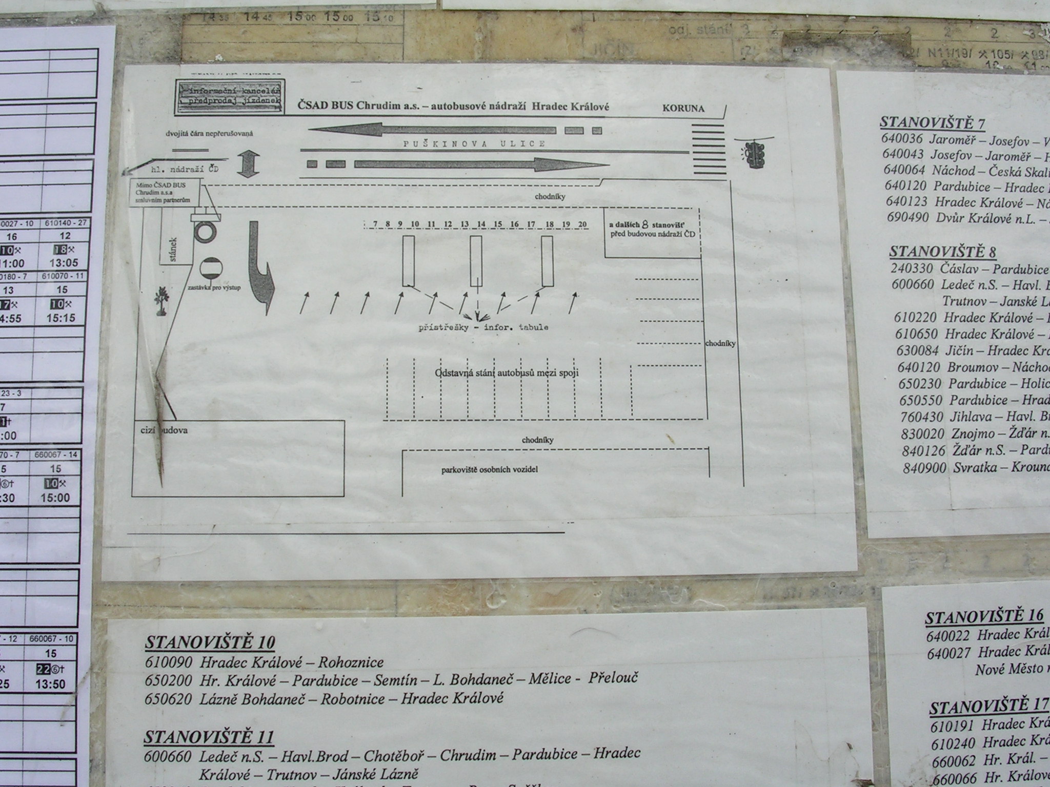
Čeština: Hradec Králové, schéma odjezdů z autobusového stanoviště Koruna, vyvěšené na autobusovém stanovišti u vlakového nádraží.
English: Hradec Králové, Hradec Králové District, Hradec Králové Region, the Czech Republic. A bus station schematic.
|
||||
| Date | |||||
| Source | photo Own work | ||||
| Author | cs:ŠJů | ||||
| Permission (Reusing this file) |
I, the copyright holder of this work, hereby publish it under the following license: This file is licensed under the Creative Commons Attribution-Share Alike 3.0 Unported license.
|
File history
Click on a date/time to view the file as it appeared at that time.
| Date/Time | Thumbnail | Dimensions | User | Comment | |
|---|---|---|---|---|---|
| current | 09:38, 29 October 2009 | | 2,048 × 1,536 (585 KB) | ŠJů (talk | contribs) | {{Information |Description= {{cs|cs:Hradec Králové, schéma odjezdů z autobusového stanoviště Koruna, vyvěšené na autobusovém stanovišti u vlakového nádraží.}} {{en|en:Hradec Králové, en:Hradec Králové District, [[:en: |
You cannot overwrite this file.
File usage on Commons
The following page uses this file: