File:Ibbenbueren Alter Friedhof Grab Wattendorff 01.jpg
Size of this preview: 400 × 600 pixels. Other resolutions: 160 × 240 pixels | 320 × 480 pixels | 512 × 768 pixels | 682 × 1,024 pixels | 1,365 × 2,048 pixels | 3,648 × 5,472 pixels.
Original file (3,648 × 5,472 pixels, file size: 14.91 MB, MIME type: image/jpeg)
Captions
Captions
Add a one-line explanation of what this file represents
Summary
edit
| Description |
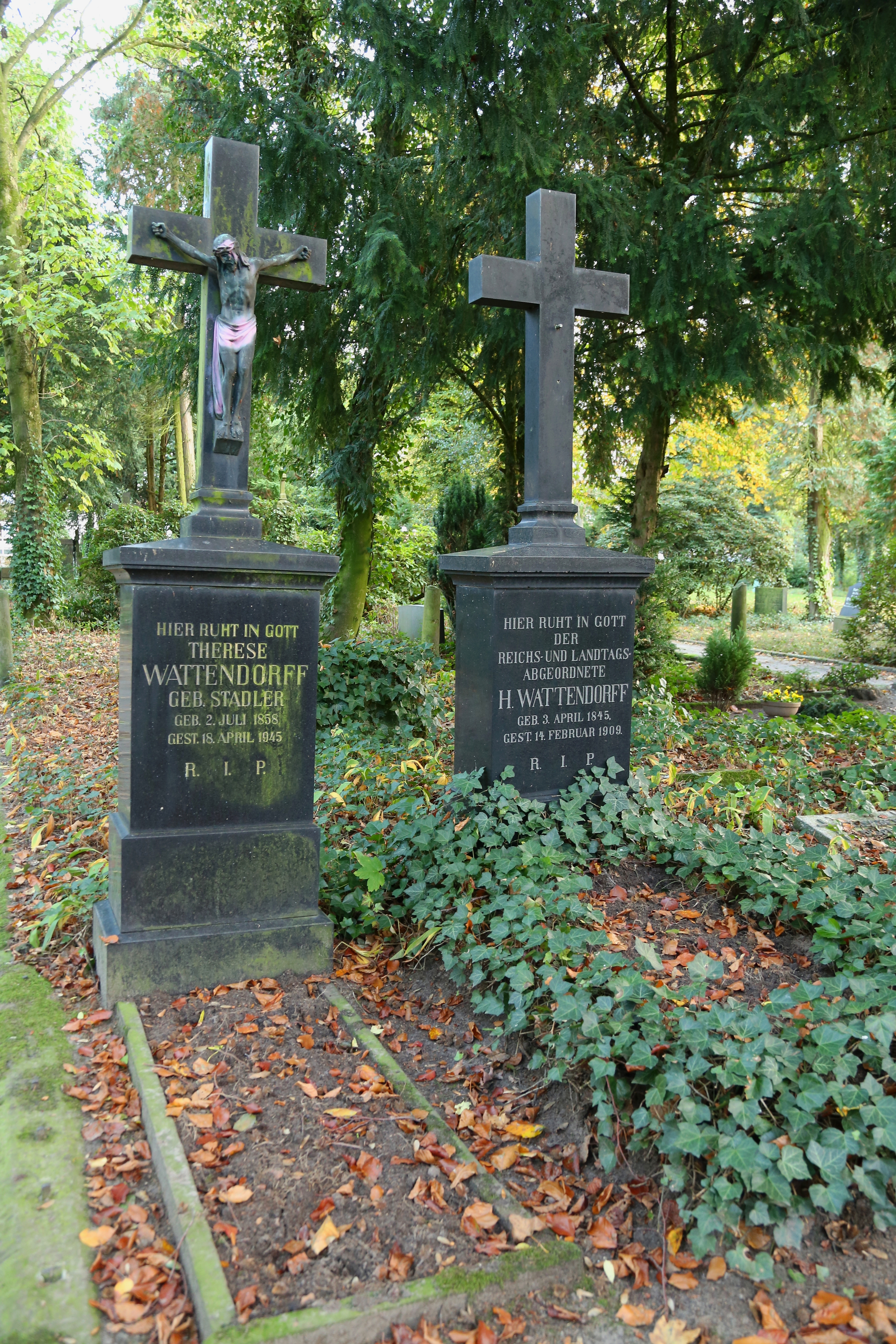
English: The grave of Heinrich Wattendorff (1845-1909), Reichstag and Landtag member, and his wife Therese née Stadler (1858-1945) on the Old Cemetery (Alter Friedhof) at School Street (Schulstraße) in Ibbenbüren, Kreis Steinfurt, North Rhine-Westphalia, Germany. Since 1984 the burial place is a listed cultural heritage monument.
Deutsch: Die Gräber des Reichstags- und Landtagsabgeordneten Heinrich Wattendorff (1845-1909) und seiner Frau Therese geborene Stadler (1858-1945) auf dem Alten Friedhof an der Schulstraße in Ibbenbüren, Kreis Steinfurt, Nordrhein-Westfalen, Deutschland. Auf dem Friedhof, der von 1837 bis 1972 in Betrieb war, befinden sich zahlreiche Grabmale bedeutender Ibbenbürener Bürger - darunter auch die Grabstelle Wattendorff. Seit 1984 steht der Bestattungsplatz komplett unter Denkmalschutz.
|
|||
| Date | ||||
| Source | Own work | |||
| Author | J.-H. Janßen |
| Camera location | | View this and other nearby images on: OpenStreetMap |
|---|
|
The photographical reproduction of this work is covered under the article § 59 of the German copyright law, which states that "It shall be permissible to reproduce, by painting, drawing, photography or cinematography, works which are permanently located on public ways, streets or places and to distribute and publicly communicate such copies. For works of architecture, this provision shall be applicable only to the external appearance."
As with all other “limits of copyright by legally permitted uses”, no changes to the actual work are permitted under § 62 of the German copyright law (UrhG). See Commons:Copyright rules by territory/Germany#Freedom of panorama for more information.
|
Licensing
edit
I, the copyright holder of this work, hereby publish it under the following licenses:

|
Permission is granted to copy, distribute and/or modify this document under the terms of the GNU Free Documentation License, Version 1.2 or any later version published by the Free Software Foundation; with no Invariant Sections, no Front-Cover Texts, and no Back-Cover Texts. A copy of the license is included in the section entitled GNU Free Documentation License. |
This file is licensed under the Creative Commons Attribution-Share Alike 3.0 Unported, 2.5 Generic, 2.0 Generic and 1.0 Generic license.
- You are free:
- to share – to copy, distribute and transmit the work
- to remix – to adapt the work
- Under the following conditions:
- attribution – You must give appropriate credit, provide a link to the license, and indicate if changes were made. You may do so in any reasonable manner, but not in any way that suggests the licensor endorses you or your use.
- share alike – If you remix, transform, or build upon the material, you must distribute your contributions under the same or compatible license as the original.
You may select the license of your choice.
File history
Click on a date/time to view the file as it appeared at that time.
| Date/Time | Thumbnail | Dimensions | User | Comment | |
|---|---|---|---|---|---|
| current | 20:29, 26 October 2013 | | 3,648 × 5,472 (14.91 MB) | J.-H. Janßen (talk | contribs) | revised |
| 20:24, 26 October 2013 |  | 3,648 × 5,472 (11.86 MB) | J.-H. Janßen (talk | contribs) | {{Information |Description ={{en|1=The grave of Heinrich Wattendorff (1845-1909), ''Reichstag'' and ''Landtag'' member, and his wife Therese née Stadler (1858-1945) on the Old Cemetery (''Alter Friedhof'') at School Street (''Schulstraße'') in [[I... |
You cannot overwrite this file.
File usage on Commons
There are no pages that use this file.
File usage on other wikis
The following other wikis use this file:
- Usage on de.wikipedia.org
- Usage on www.wikidata.org