File:Ihnc-07.jpg

Size of this preview: 590 × 599 pixels. Other resolutions: 236 × 240 pixels | 473 × 480 pixels | 766 × 778 pixels.
Original file (766 × 778 pixels, file size: 90 KB, MIME type: image/jpeg)
Captions
Captions
Add a one-line explanation of what this file represents
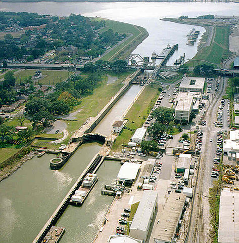
An aerial photograph of the Inner Harbor Navigation Canal Lock (Industrial Canal Lock), looking toward the Lower Mississippi River. Includes barges, towboats, and the St. Claude Avenue Bridge. Lower 9th Ward of New Orleans is to the left; Bywater neighborhood to right of Canal.
Sourced from [1]
Previously uploaded to en:Wikipedia on 16:02, 2 April 2006 by en:User:Muffuletta
This image or file is a work of a U.S. Army Corps of Engineers soldier or employee, taken or made as part of that person's official duties. As a work of the U.S. federal government, the image is in the public domain.
|
File history
Click on a date/time to view the file as it appeared at that time.
| Date/Time | Thumbnail | Dimensions | User | Comment | |
|---|---|---|---|---|---|
| current | 12:33, 11 March 2007 | | 766 × 778 (90 KB) | Infrogmation (talk | contribs) | An aerial photograph of the Inner Harbor Navigation Canal Lock (Industrial Canal Lock), looking toward the Lower Mississippi River. Includes barges, towboats, and the St. Claude Avenue Bridge. Lower 9th Ward of New Orleans is to the left; Bywater neighbo |
You cannot overwrite this file.
File usage on Commons
There are no pages that use this file.
File usage on other wikis
The following other wikis use this file:
- Usage on en.wikipedia.org