File:India Pakistan Locator.png

Size of this preview: 800 × 370 pixels. Other resolutions: 320 × 148 pixels | 640 × 296 pixels | 1,357 × 628 pixels.
Original file (1,357 × 628 pixels, file size: 24 KB, MIME type: image/png)
Captions
Captions
Add a one-line explanation of what this file represents

|
This locator map image could be re-created using vector graphics as an SVG file. This has several advantages; see Commons:Media for cleanup for more information. If an SVG form of this image is available, please upload it and afterwards replace this template with
{{vector version available|new image name}}.
It is recommended to name the SVG file “India Pakistan Locator.svg”—then the template Vector version available (or Vva) does not need the new image name parameter. |
Summary edit
| Description |
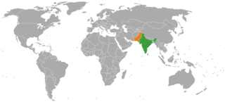
English: Map showing the location of India and Pakistan. |
| Date | |
| Source | Own work |
| Author | The life of brian |
| This is a retouched picture, which means that it has been digitally altered from its original version. Modifications: Replacing USA and Canada with India and Pakistan. The original can be viewed here: Canada USA Locator.png:
|
Licensing edit
| I, the copyright holder of this work, release this work into the public domain. This applies worldwide. In some countries this may not be legally possible; if so: I grant anyone the right to use this work for any purpose, without any conditions, unless such conditions are required by law. |
File history
Click on a date/time to view the file as it appeared at that time.
| Date/Time | Thumbnail | Dimensions | User | Comment | |
|---|---|---|---|---|---|
| current | 19:11, 14 August 2017 | | 1,357 × 628 (24 KB) | XXN (talk | contribs) | Fixed the problem with Hawaii and other island (non-Indian territories) |
| 03:59, 22 September 2012 |  | 1,357 × 628 (28 KB) | Magog the Ogre (talk | contribs) | Reverted to version as of 15:47, 16 November 2008 - please use the full resolution version | |
| 23:31, 27 March 2009 |  | 800 × 370 (65 KB) | Swusr~commonswiki (talk | contribs) | fix: previously Hawai'i and 2 other islands were highlighted the color of either India or Pakistan, as if they were colonies/possessions of those countries | |
| 15:47, 16 November 2008 |  | 1,357 × 628 (28 KB) | The life of brian (talk | contribs) | {{Information |Description={{en|1=Map showing the location of India and Pakistan.}} |Source=Own work |Author=The life of brian |Date=16.11.2008 |Permission= |other_versions= }} {{RetouchedPicture|Replacing USA and CAnada with In |
You cannot overwrite this file.
File usage on Commons
The following 6 pages use this file:
File usage on other wikis
The following other wikis use this file:
- Usage on ca.wikipedia.org
- Usage on ckb.wikipedia.org
- Usage on en.wikipedia.org
- Usage on es.wikipedia.org
- Usage on fa.wikipedia.org
- Usage on fi.wikipedia.org
- Usage on fr.wikipedia.org
- Usage on fr.wikinews.org
- Usage on id.wikipedia.org
- Usage on ja.wikipedia.org
- Usage on mzn.wikipedia.org
- Usage on nl.wikipedia.org
- Usage on pa.wikipedia.org
- Usage on pt.wikipedia.org
- Usage on ru.wikipedia.org
- Usage on uk.wikipedia.org
- Usage on www.wikidata.org