File:Ireland's southeast end.jpg

Size of this preview: 616 × 599 pixels. Other resolutions: 247 × 240 pixels | 493 × 480 pixels | 789 × 768 pixels | 1,053 × 1,024 pixels | 2,105 × 2,048 pixels | 4,634 × 4,508 pixels.
Original file (4,634 × 4,508 pixels, file size: 4.89 MB, MIME type: image/jpeg)
Captions
Captions
Add a one-line explanation of what this file represents
Summary
edit
| Description |
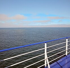
English: Ireland's southeast end between Carnsore Point and Greenore Point, seen from the Irish Sea Gaeilge: Ceann thoir theas na hÉireann idir An Carn agus Rinn an Ghrianfoirt, le feiceáil ó Mhuir Éireann |
| Date | |
| Source | Self-photographed |
| Author | Rauenstein |
| Permission (Reusing this file) |
This file is licensed under the Creative Commons Attribution-Share Alike 3.0 Unported, 2.5 Generic, 2.0 Generic and 1.0 Generic license.
|
| Camera location | | View this and other nearby images on: OpenStreetMap |
|---|
File history
Click on a date/time to view the file as it appeared at that time.
| Date/Time | Thumbnail | Dimensions | User | Comment | |
|---|---|---|---|---|---|
| current | 08:47, 3 October 2023 | | 4,634 × 4,508 (4.89 MB) | Rauenstein (talk | contribs) | == {{int:filedesc}} == {{Information |Description={{en|Ireland's southeast end between Carnsore Point and Greenore Point, seen from the Irish Sea}} {{ga|Ceann thoir theas na hÉireann idir An Carn agus Rinn an Ghrianfoirt, le feiceáil ó Mhuir Éireann}} |Source={{self-photographed}} |Date=2023-09-01 |Author=Rauenstein |Permission={{cc-by-sa-3.0,2.5,2.0,1.0}} |other_versions= }} {{Location|52|3|49.86|N|6|15|50.53|W|heading:NW}} [[Categ... |
You cannot overwrite this file.
File usage on Commons
There are no pages that use this file.