File:Iturbide Campeche 1986 Sketch Map.jpg
Size of this preview: 382 × 599 pixels. Other resolutions: 153 × 240 pixels | 306 × 480 pixels | 744 × 1,166 pixels.
Original file (744 × 1,166 pixels, file size: 374 KB, MIME type: image/jpeg)
Captions
Captions
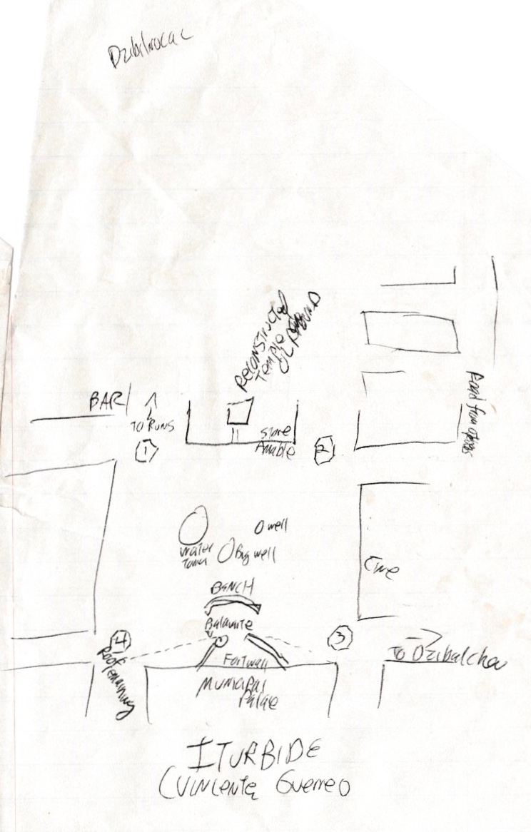
Iturbide Campeche sketch map, 1986
Summary
edit
| Description |
English: Town square, Iturbide Campeche, aka Vicente Guerrero de Hopelchen, near the ruins of Dzibilnocac, rough sketch map from my notebook, 18 June 1986.
Notes road to ruins of Dzibilnocac, road to town of Dzibilchen, location of 4 small fortifications (likely from the 19th century "Caste War of Yucatan" and structures around the main square at the time. The type of things done when no print map could be found - way before google maps. |
| Date | |
| Source | https://www.flickr.com/photos/infrogmation/48862066421/ |
| Author | Infrogmation of New Orleans |
Licensing
edit
This file is licensed under the Creative Commons Attribution 2.0 Generic license.
- You are free:
- to share – to copy, distribute and transmit the work
- to remix – to adapt the work
- Under the following conditions:
- attribution – You must give appropriate credit, provide a link to the license, and indicate if changes were made. You may do so in any reasonable manner, but not in any way that suggests the licensor endorses you or your use.
| This image was originally posted to Flickr by Infrogmation at https://flickr.com/photos/29350288@N06/48862066421 (archive). It was reviewed on 12 October 2019 by FlickreviewR 2 and was confirmed to be licensed under the terms of the cc-by-2.0. |
File history
Click on a date/time to view the file as it appeared at that time.
| Date/Time | Thumbnail | Dimensions | User | Comment | |
|---|---|---|---|---|---|
| current | 23:05, 12 October 2019 | | 744 × 1,166 (374 KB) | Infrogmation (talk | contribs) | User created page with UploadWizard |
You cannot overwrite this file.
File usage on Commons
There are no pages that use this file.