File:Jefferson Parish Louisiana Riverfront New Orleans Map 1979.jpg

Size of this preview: 487 × 599 pixels. Other resolutions: 195 × 240 pixels | 390 × 480 pixels | 624 × 768 pixels | 832 × 1,024 pixels | 1,664 × 2,048 pixels | 3,657 × 4,500 pixels.
Original file (3,657 × 4,500 pixels, file size: 5.08 MB, MIME type: image/jpeg)
Captions
Captions
Add a one-line explanation of what this file represents
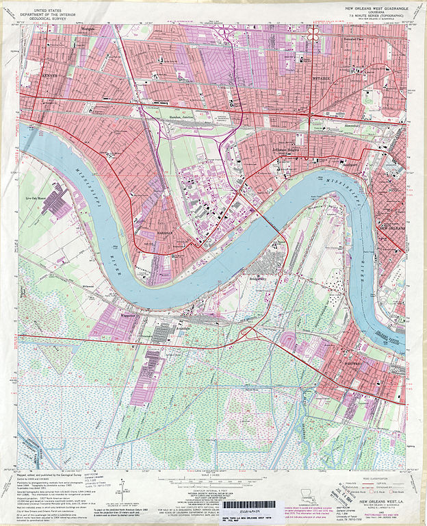
| Description | 1979 map of section of Greater New Orleans, showing portion of Jefferson Parish along and near the Mississippi River, including Kenner, Old Jefferson, Old Metarie, Southport, Harahan, Shrewsbury, Waggaman, Avandale, Nine Mile Point, Bridge City, and Westwego; also seen is a small portion of New Orleans at and around the Carrollton Riverbend above Audubon Park. | |||
| Date | ||||
| Source | U.S. Geological Survey map, 1979, via [1] | |||
| Author | U.S. Geological Survey | |||
| Permission (Reusing this file) |
|
File history
Click on a date/time to view the file as it appeared at that time.
| Date/Time | Thumbnail | Dimensions | User | Comment | |
|---|---|---|---|---|---|
| current | 21:37, 19 June 2012 | | 3,657 × 4,500 (5.08 MB) | Infrogmation (talk | contribs) | {{Information |Description= 1979 map of section of Greater New Orleans, showing portion of Jefferson Parish along and near the Mississippi River, including Old Jefferson, Old Metarie, Southport, Harahan, Shrewsbury, Waggaman, Avandale, Nine Mile Point,... |
You cannot overwrite this file.
File usage on Commons
There are no pages that use this file.