File:Kahoolawe from Hawaiian Airlines Flight from Honolulu to Kona (3) (4548767947).jpg

Original file (2,816 × 2,112 pixels, file size: 1.89 MB, MIME type: image/jpeg)
Captions
Captions
Summary edit
_(4548767947).jpg&action=edit§ion=1)
| Description |
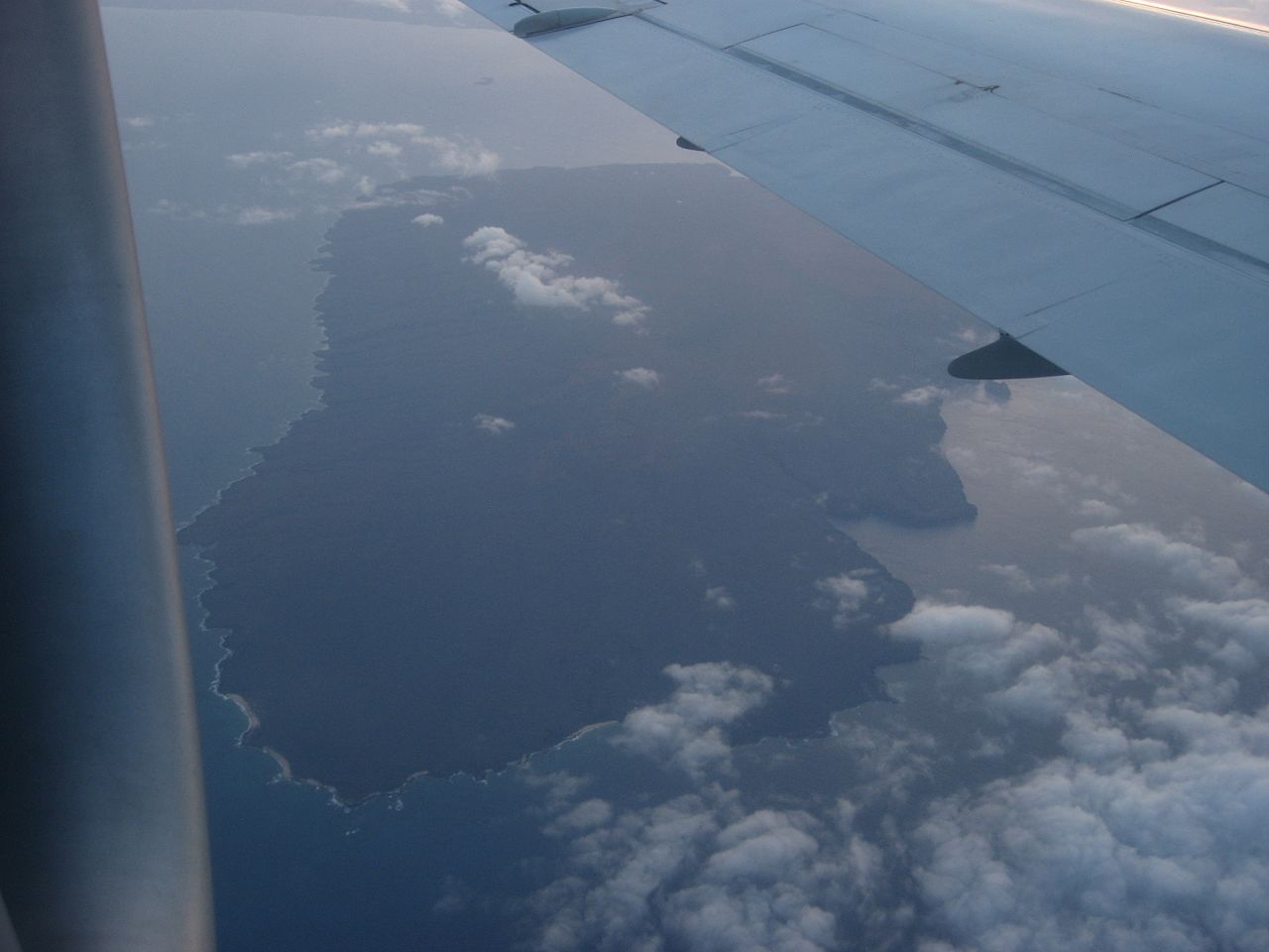
Kahoʻolawe is the smallest of the eight main volcanic islands in the Hawaiian Islands. Kahoʻolawe is located about seven miles (11.2 km) southwest of Maui and also southeast of Lanai, and it is 11 miles (18 km) long by 6.0 miles (9.7 km) wide, with a total land area of 44.97 square miles (116.5 km2). The highest point on Kahoʻolawe is the crater of Lua Makika at the summit of Puʻu Moaulanui, which is about 1,477 feet (450 m) above sea level. Kahoʻolawe is relatively dry (average annual rainfall is less than 65 cm or 26 in) because the island's low elevation fails to generate much orographic precipitation from the northeastern trade winds, and Kahoolawe is located in the rain shadow of eastern Maui's 10,023 feet (3,055 m) high volcano, Haleakalā. More than one quarter of Kahoʻolawe has been eroded down to saprolitic hardpan soil. Kahoʻolawe has always been sparsely populated, due to its lack of fresh water. During World War II, Kahoʻolawe was used as a training ground and bombing range by the Armed Forces of the United States. After decades of protests, the U.S. Navy ended live-fire training exercises on Kahoolawe in 1990, and the whole island was transferred to the jurisdiction of the State of Hawaii in 1994. The Hawaii State Legislature established the Kahoolawe Island Reserve to restore and to oversee the island and its surrounding waters. Today Kahoolawe can be used only for native Hawaiian cultural, spiritual, and subsistence purposes. en.wikipedia.org/wiki/Kahoolawe en.wikipedia.org/wiki/Wikipedia:Text_of_Creative_Commons_... |
| Date | |
| Source | Kahoolawe from Hawaiian Airlines Flight from Honolulu to Kona (3) |
| Author | Ken Lund from Reno, Nevada, USA |
| Camera location | | View this and other nearby images on: OpenStreetMap |
|---|
_(4548767947).jpg¶ms=020.496652_N_-156.716537_E_globe:Earth_type:camera_source:Flickr_&language=en)
Licensing edit
_(4548767947).jpg&action=edit§ion=2)
- You are free:
- to share – to copy, distribute and transmit the work
- to remix – to adapt the work
- Under the following conditions:
- attribution – You must give appropriate credit, provide a link to the license, and indicate if changes were made. You may do so in any reasonable manner, but not in any way that suggests the licensor endorses you or your use.
- share alike – If you remix, transform, or build upon the material, you must distribute your contributions under the same or compatible license as the original.
| This image was originally posted to Flickr by Ken Lund at https://flickr.com/photos/75683070@N00/4548767947. It was reviewed on 3 December 2015 by FlickreviewR and was confirmed to be licensed under the terms of the cc-by-sa-2.0. |
File history
Click on a date/time to view the file as it appeared at that time.
| Date/Time | Thumbnail | Dimensions | User | Comment | |
|---|---|---|---|---|---|
| current | 22:10, 3 December 2015 | | 2,816 × 2,112 (1.89 MB) | INeverCry (talk | contribs) | Transferred from Flickr via Flickr2Commons |
You cannot overwrite this file.
File usage on Commons
There are no pages that use this file.
_(4548767947).jpg&oldid=484273490)