File:Karolinska Institutet Science Park.JPG
Size of this preview: 800 × 534 pixels. Other resolutions: 320 × 214 pixels | 640 × 428 pixels | 1,024 × 684 pixels | 1,280 × 855 pixels | 2,560 × 1,710 pixels | 3,832 × 2,560 pixels.
Original file (3,832 × 2,560 pixels, file size: 1.77 MB, MIME type: image/jpeg)
File information
Structured data
Captions
Captions
Add a one-line explanation of what this file represents
Summary
editDescriptionKarolinska Institutet Science Park.JPG |
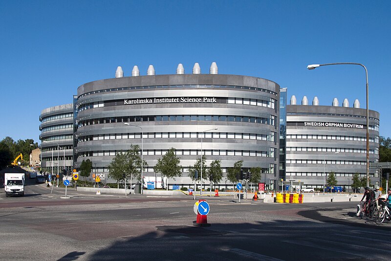
Svenska: Karolinska Institutet Science Park i korsningen Tomtebodavägen/Solnavägen. Invigt 2010. Ansvariga arkitekter Stefan Ekholm, Peter Lindberg och Jon Tvedt på SWECO |
Date | |
Source | Own work |
Author | I99pema |
Camera location | 59° 21′ 01.52″ N, 18° 01′ 30.4″ E ![]() ![]() | View this and other nearby images on: OpenStreetMap | ![]() |
---|
Licensing
editI, the copyright holder of this work, hereby publish it under the following license:
![w:en:Creative Commons](https://upload.wikimedia.org/wikipedia/commons/thumb/7/79/CC_some_rights_reserved.svg/90px-CC_some_rights_reserved.svg.png)
![attribution](https://upload.wikimedia.org/wikipedia/commons/thumb/1/11/Cc-by_new_white.svg/24px-Cc-by_new_white.svg.png)
![share alike](https://upload.wikimedia.org/wikipedia/commons/thumb/d/df/Cc-sa_white.svg/24px-Cc-sa_white.svg.png)
This file is licensed under the Creative Commons Attribution-Share Alike 4.0 International license.
- You are free:
- to share – to copy, distribute and transmit the work
- to remix – to adapt the work
- Under the following conditions:
- attribution – You must give appropriate credit, provide a link to the license, and indicate if changes were made. You may do so in any reasonable manner, but not in any way that suggests the licensor endorses you or your use.
- share alike – If you remix, transform, or build upon the material, you must distribute your contributions under the same or compatible license as the original.
File history
Click on a date/time to view the file as it appeared at that time.
Date/Time | Thumbnail | Dimensions | User | Comment | |
---|---|---|---|---|---|
current | 14:38, 5 May 2019 | 3,832 × 2,560 (1.77 MB) | Holger.Ellgaard (talk | contribs) | puts | |
09:00, 2 May 2018 | 4,129 × 2,753 (3.36 MB) | I99pema (talk | contribs) | Reverted to version as of 16:45, 26 June 2015 (UTC) Do not override previous upload with new image. Create a new upload with new name! | ||
08:24, 2 May 2018 | 3,055 × 1,798 (453 KB) | Abdeaitali (talk | contribs) | The building with the new name: Science for Life Laboratory | ||
16:45, 26 June 2015 | 4,129 × 2,753 (3.36 MB) | I99pema (talk | contribs) | User created page with UploadWizard |
You cannot overwrite this file.
File usage on Commons
The following page uses this file:
File usage on other wikis
The following other wikis use this file:
- Usage on ar.wikipedia.org
- Usage on arz.wikipedia.org
- Usage on en.wikipedia.org
- Usage on fa.wikipedia.org
- Usage on ja.wikipedia.org
- Usage on sv.wikipedia.org
- Usage on www.wikidata.org
Metadata
This file contains additional information such as Exif metadata which may have been added by the digital camera, scanner, or software program used to create or digitize it. If the file has been modified from its original state, some details such as the timestamp may not fully reflect those of the original file. The timestamp is only as accurate as the clock in the camera, and it may be completely wrong.
Camera manufacturer | NIKON CORPORATION |
---|---|
Camera model | NIKON D90 |
Exposure time | 1/200 sec (0.005) |
F-number | f/14 |
ISO speed rating | 200 |
Date and time of data generation | 07:35, 3 July 2013 |
Lens focal length | 20 mm |
Latitude | 59° 21′ 1.52″ N |
Longitude | 18° 1′ 30.4″ E |
Orientation | Normal |
Horizontal resolution | 240 dpi |
Vertical resolution | 240 dpi |
Software used | ArcSoft PhotoStudio |
File change date and time | 16:38, 5 May 2019 |
Exposure Program | Not defined |
Exif version | 2.2 |
Date and time of digitizing | 07:35, 3 July 2013 |
Meaning of each component |
|
APEX shutter speed | 7.643856 |
APEX aperture | 7.61471 |
APEX exposure bias | 0 |
Maximum land aperture | 3.7 APEX (f/3.61) |
Metering mode | Pattern |
Light source | Unknown |
Flash | Flash did not fire, auto mode |
DateTime subseconds | 00 |
DateTimeOriginal subseconds | 00 |
DateTimeDigitized subseconds | 00 |
Supported Flashpix version | 1 |
Color space | Uncalibrated |
Sensing method | One-chip color area sensor |
File source | Digital still camera |
Scene type | A directly photographed image |
Custom image processing | Normal process |
Exposure mode | Auto exposure |
White balance | Auto white balance |
Digital zoom ratio | 1 |
Focal length in 35 mm film | 30 mm |
Scene capture type | Standard |
Scene control | None |
Contrast | Normal |
Saturation | Normal |
Sharpness | Normal |
Subject distance range | Unknown |
GPS time (atomic clock) | 07:35 |
Reference for direction of image | True direction |
Direction of image | 274.57 |
Geodetic survey data used | WGS-84 |
Latitude destination | 59° 21′ 1.88″ N |
Longitude of destination | 18° 1′ 21.69″ E |
GPS date | 3 July 2013 |
Lens used | 18.0-200.0 mm f/3.5-5.6 |
Serial number of camera | 8196890 |
GPS tag version | 2.2.0.0 |
Date metadata was last modified | 09:57, 25 June 2015 |
Rating (out of 5) | 0 |
Unique ID of original document | 2599A5EDE03AF909B6C11C52FDA6CE0B |
IIM version | 32,768 |