File:Karte Etzenrather Mühle.jpg

Size of this preview: 800 × 467 pixels. Other resolutions: 320 × 187 pixels | 640 × 374 pixels | 911 × 532 pixels.
Original file (911 × 532 pixels, file size: 102 KB, MIME type: image/jpeg)
Captions
Captions
Add a one-line explanation of what this file represents
Summary
edit
| Description |
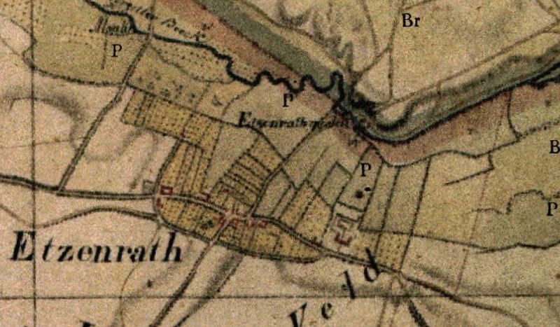
Deutsch: Kartenaufnahme der Rheinlande durch Tranchot und von Müffling 1804/05, Ausschnitt mit dem Gebiet der Ortschaft Etzenrade (NL) (damals: Etzenrath) und der Etzenrather Mühle (D).
Nederlands: Topografische opname van't Rijnland door Tranchot en von Müffling 1804/05, uittreksel met het gebied van Etzenrade (NL) (toen: Etzenrath) en de Etzenrather Mühle (D) (Etzenraadse Molen). |
| Source | Landesvermessungsamt NRW |
| Author | Tranchot u. von Müffling 1803-1820 |
Licensing
edit
|
This work is in the public domain in its country of origin and other countries and areas where the copyright term is the author's life plus 70 years or fewer. This work is in the public domain in the United States because it was published (or registered with the U.S. Copyright Office) before January 1, 1929. | |
| This file has been identified as being free of known restrictions under copyright law, including all related and neighboring rights. | |
File history
Click on a date/time to view the file as it appeared at that time.
| Date/Time | Thumbnail | Dimensions | User | Comment | |
|---|---|---|---|---|---|
| current | 19:02, 19 June 2012 | | 911 × 532 (102 KB) | Huckety (talk | contribs) |
You cannot overwrite this file.
File usage on Commons
The following page uses this file:
File usage on other wikis
The following other wikis use this file:
- Usage on de.wikipedia.org