File:Koppen-Geiger Map BGD future.svg

Size of this PNG preview of this SVG file: 779 × 600 pixels. Other resolutions: 312 × 240 pixels | 624 × 480 pixels | 998 × 768 pixels | 1,280 × 986 pixels | 2,560 × 1,971 pixels | 1,104 × 850 pixels.
Original file (SVG file, nominally 1,104 × 850 pixels, file size: 1.14 MB)
Captions
Captions
Add a one-line explanation of what this file represents
Summary
edit
| Description |
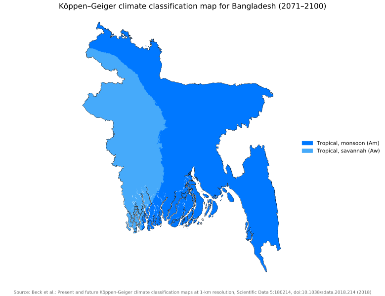
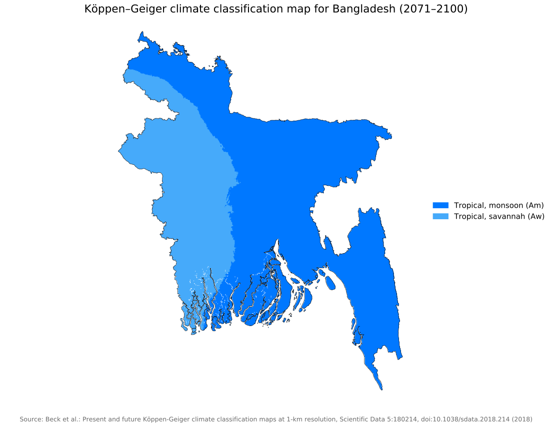
English: Köppen–Geiger climate classification map for Bangladesh |
| Date | |
| Source | "Present and future Köppen-Geiger climate classification maps at 1-km resolution". Nature Scientific Data. DOI:10.1038/sdata.2018.214. |
| Author | Beck, H.E., Zimmermann, N. E., McVicar, T. R., Vergopolan, N., Berg, A., & Wood, E. F. |
Licensing
edit
This file is licensed under the Creative Commons Attribution 4.0 International license.
- You are free:
- to share – to copy, distribute and transmit the work
- to remix – to adapt the work
- Under the following conditions:
- attribution – You must give appropriate credit, provide a link to the license, and indicate if changes were made. You may do so in any reasonable manner, but not in any way that suggests the licensor endorses you or your use.
| Camera location | | View this and other nearby images on: OpenStreetMap |
|---|
File history
Click on a date/time to view the file as it appeared at that time.
| Date/Time | Thumbnail | Dimensions | User | Comment | |
|---|---|---|---|---|---|
| current | 03:39, 26 November 2018 | | 1,104 × 850 (1.14 MB) | NVergopolan (talk | contribs) | {{Information |Description={{en| Köppen–Geiger climate classification map for Bangladesh}}|date=2018-11-06|source={{cite journal | title=Present and future Köppen-Geiger climate classification maps at 1-km resolution | journal=Nature Scientific Data |doi=10.1038/sdata.2018.214}}|author=Beck, H.E., Zimmermann, N. E., McVicar, T. R., Vergopolan, N., Berg, A., & Wood, E. F.|permission=|other_versions=|other_fields=}}{{Cc-by-4.0}}{{Location|23.68759251|90.342113495}}[[Category:Köppen-Geiger Clima... |
You cannot overwrite this file.
File usage on Commons
There are no pages that use this file.
File usage on other wikis
The following other wikis use this file:
- Usage on en.wikipedia.org
- Usage on es.wikipedia.org
- Usage on mdf.wikipedia.org
- Usage on sv.wikipedia.org