File:Lange diercke sachsen gebiet des windbergs reichskarte.jpg
Size of this preview: 800 × 407 pixels. Other resolutions: 320 × 163 pixels | 640 × 325 pixels | 1,164 × 592 pixels.
Original file (1,164 × 592 pixels, file size: 482 KB, MIME type: image/jpeg)
Captions
Captions
Add a one-line explanation of what this file represents
| Lange-Diercke – Sächsischer Schulatlas | ||||||
|---|---|---|---|---|---|---|
| Author |
Anonymous |
 | ||||
| Title |
Lange-Diercke – Sächsischer Schulatlas |
|||||
| Subtitle | Ausgabe für Dresden | |||||
| Publisher |
Georg Westermann (Braunschweig) Carl Adlers Buchhandlung (Dresden) |
|||||
| Description |
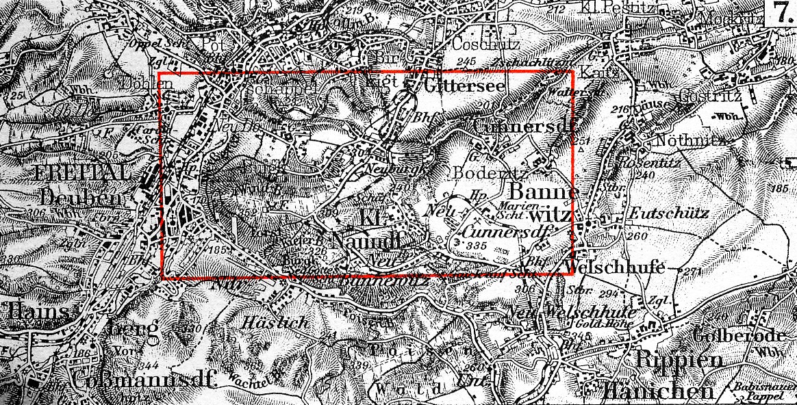
Deutsch: Geländedarstellung: Gebiet des Windbergs (Freital, Sachsen), Darstellung der Reichskarte (1:100.000)
English: This is a part of an old atlas. It does not necessarily represent the current situation. |
|||||
| Publication date | circa 1930 | |||||
| Place of publication | Brunswick, Dresden | |||||
| Permission (Reusing this file) |
|
|||||
| Other versions |
|
|||||


File history
Click on a date/time to view the file as it appeared at that time.
| Date/Time | Thumbnail | Dimensions | User | Comment | |
|---|---|---|---|---|---|
| current | 17:05, 22 January 2011 | | 1,164 × 592 (482 KB) | Bananenfalter (talk | contribs) | {{Lange-Diercke_Sachsen |Description={{de|1=Geländedarstellung: Gebiet des Windbergs (Freital, Sachsen), Darstellung der Reichskarte (1:100.000)}} |Author=Bananenfalter }} {{subst:unc}} |
You cannot overwrite this file.
File usage on Commons
The following 2 pages use this file: