File:Lauttasaari Länsiulapanniemi rangefinder tower.JPG

Size of this preview: 450 × 600 pixels. Other resolutions: 180 × 240 pixels | 360 × 480 pixels | 576 × 768 pixels | 768 × 1,024 pixels | 1,536 × 2,048 pixels | 2,736 × 3,648 pixels.
Original file (2,736 × 3,648 pixels, file size: 3.98 MB, MIME type: image/jpeg)
Captions
Captions
Add a one-line explanation of what this file represents
Summary
edit
| Description |
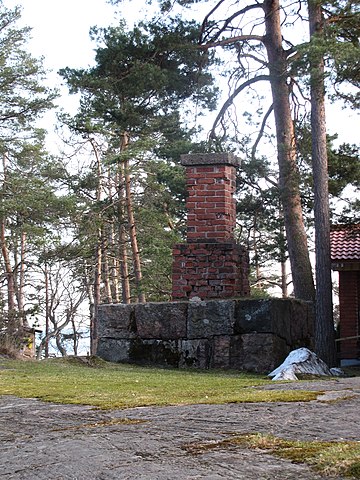
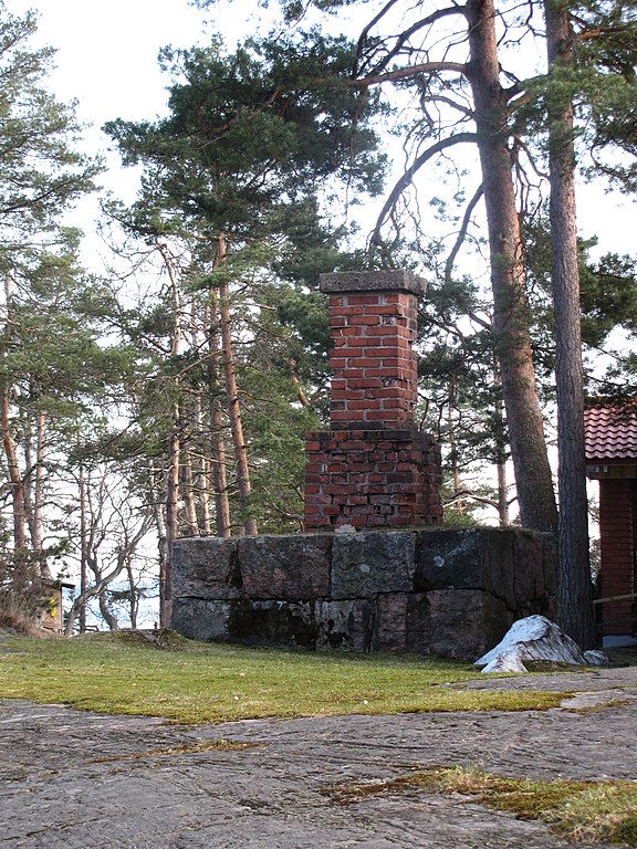
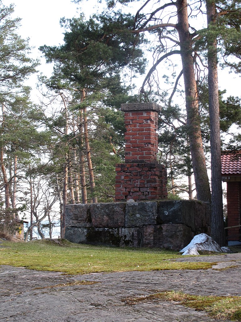
English: Remnants of a vertical based rangefinder tower from mid-1880s at Länsiulapanniemi in Lauttasaari.
Suomi: Pystykantaetäisyysmittaustornin jäänteet 1880-luvun puolivälistä Lauttasaaren Länsiulapanniemessä. |
| Date | |
| Source | Own work |
| Author | MKFI |
| Camera location | | View this and other nearby images on: OpenStreetMap |
|---|
Licensing
edit
| I, the copyright holder of this work, release this work into the public domain. This applies worldwide. In some countries this may not be legally possible; if so: I grant anyone the right to use this work for any purpose, without any conditions, unless such conditions are required by law. |
File history
Click on a date/time to view the file as it appeared at that time.
| Date/Time | Thumbnail | Dimensions | User | Comment | |
|---|---|---|---|---|---|
| current | 19:45, 28 April 2010 | | 2,736 × 3,648 (3.98 MB) | MKFI (talk | contribs) | {{Information |Description={{en|1=Remnants of a vertical based rangefinder tower from mid-1880s at Länsiulapanniemi in Lauttasaari.}} {{fi|1=Pystykantaetäisyysmittaustornin jäänteet Lauttasaaren Länsiulapanniemessä.}} |Source={{own}} |Author=[[User: |
You cannot overwrite this file.
File usage on Commons
There are no pages that use this file.